WILD HONG KONG
  • Home
  • Our Guided Tours
    • Hiking Tours >
      • Easier Classic HK Hikes >
        • Dragon's Back Trail
        • Victoria Peak (The Peak)
        • Lion Rock
      • Moderate Wilderness Hikes >
        • Ng Tung Chai Waterfalls
        • Sai Kung Deserted Beaches
        • Sai Kung Geopark Coastal Hike
      • Challenging Hikes >
        • Ma On Shan Climb
        • Wong Lung Hang Stream Trek
        • Lantau Peak Sunrise Climb
    • Cycling Tours >
      • Wetlands Cycle
      • Tolo Harbour Cycle
      • Plover Cove Cycle and Hike
      • Tai Lam Mountain Biking
    • Kayaking & SUP Tours >
      • Geopark Kayaking ​(Beginner / Intermediate Level)
      • Geopark Kayaking Sea Arches (Advanced Level)
      • Hoi Ha Kayaking
      • Sai Kung SUP
    • Events, Programmes & Team Building
    • School Holiday Adventure Programmes >
      • Kayaking - 5 Day Programme
      • Mixed Activities - 5 Day Programme
      • Hiking & Stream Trekking - 5 Day Programme
    • Gift Vouchers
  • Book A Tour
  • About us
  • Merchandise
    • Clothing
    • Hats
    • Accessories
  • More
    • Blog
    • Media
    • Weather Forecast
    • General Requirements
    • Terms and Conditions
    • FAQs
    • Contact Us
  • 🌐
    • 中文
    • English
    • Français

Tate’s Cairn –Where three sides of Hong Kong meet

5/5/2017

4 Comments

 
​For those who thought The Peak was the most dramatic summit looming over Victoria Harbour, think again. There are some incredible vistas to the north of Kowloon.
 
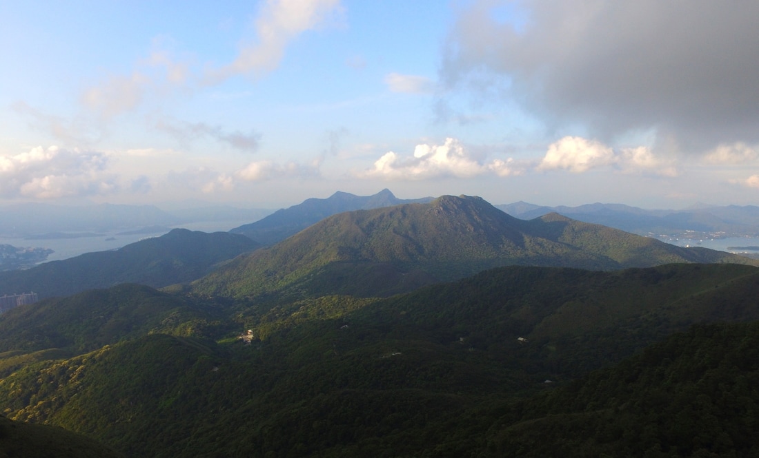
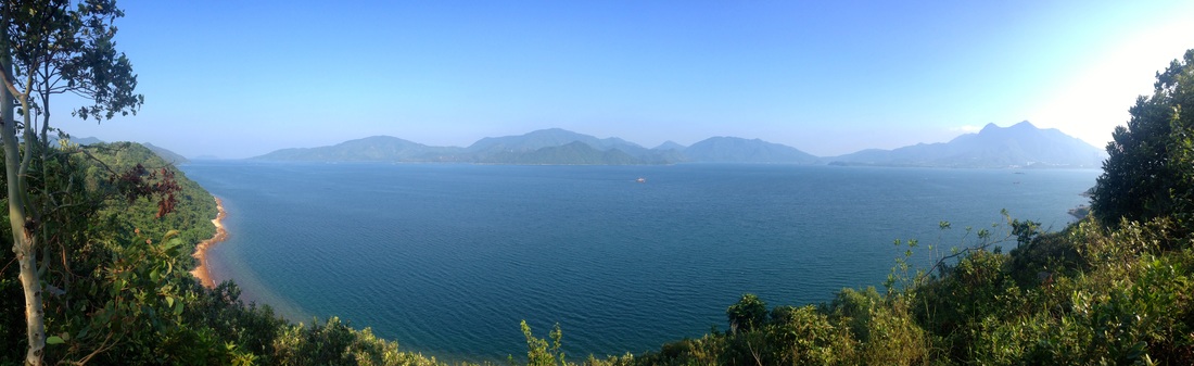
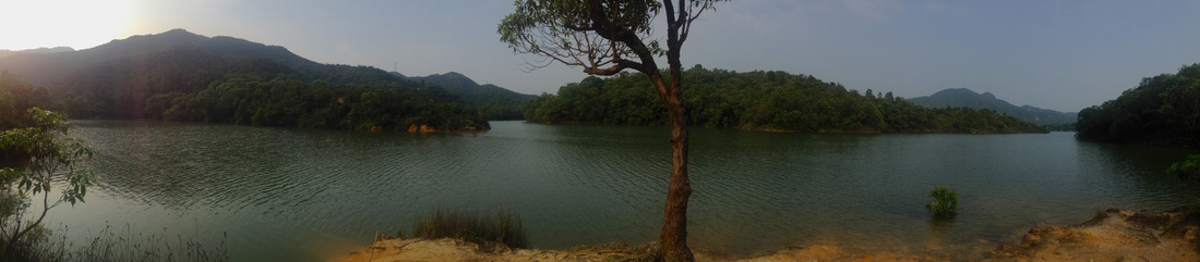
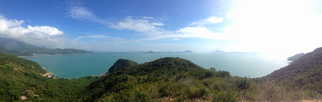
It may not be as well known, but Tate’s Cairn and the adjacent Kowloon Peak is right up there in terms of grandeur. Conquer this rugged ridge and one will witness some of Hong Kong’s finest views. Feel the intense sprawl of Kowloon and enjoy the iconic backdrop of HK Island behind. Meanwhile a gaze round the other side reveals Sai Kung Country Park, Sha Tin Valley and the expansive hills of the New Territories. Not only is being at the top incredible, but the walking to be had either side is most enjoyable.
Picture
Picture
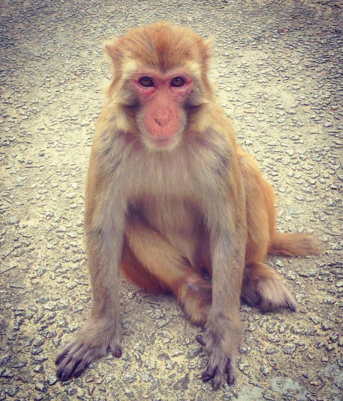
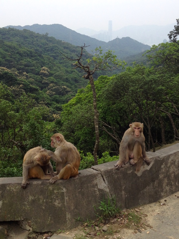
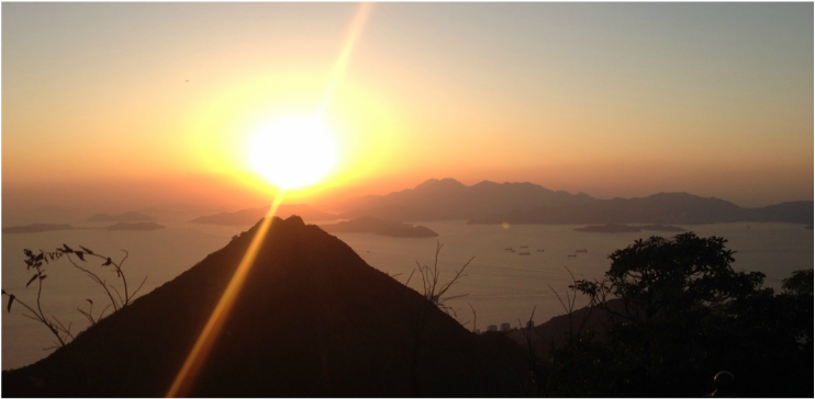
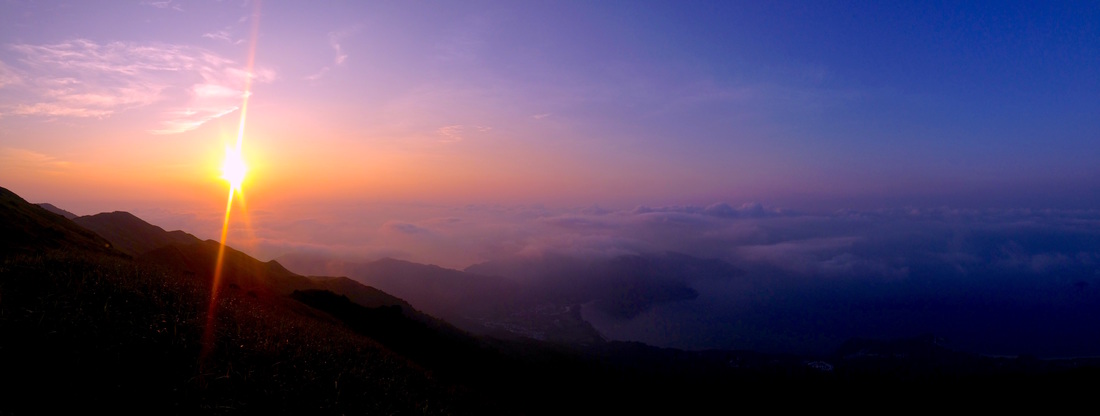
Mid afternoons make an ideal time to set off, ensuring cooler temperatures and sunset vistas from the summit ridge. The route up is easily accessed from Wong Tai Sin MTR Station. Find exit E and begin climbing up Sha Tin Pass Road, stay on Sha Tin Pass Road and you shall gradually rise above the tower blocks of Kowloon. After about 45 minutes of walking, you’ll intercept the Wilson Trail (Stage 4). Turn right and follow the road up towards the ridge line. Walk through the lush forests of Lion Rock Country Park before emerging upon more grassy terrain. Keep an eye out for wildlife along the way, in particular monkeys.
 
For those who want a much shorter stroll, upon reaching the junction between Fei Ngo Shan Road and Jat’s Incline, simply walk back down into Choi Hung via Jat’s Incline. Otherwise I recommend following Fei Ngo Shan Road to the mountain ridge where the Tate’s Cairn Weather Observatory is located.

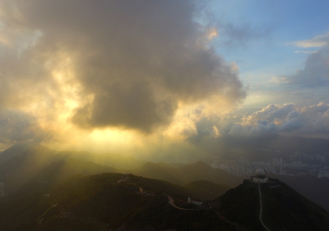
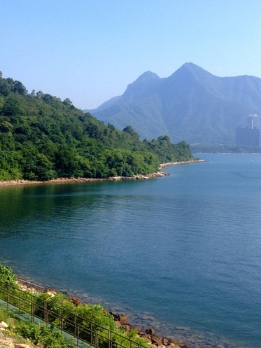
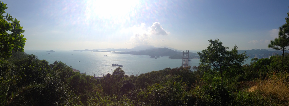
​Upon the reaching the summit at 583 meters above sea level, the route emerges from undergrowth to reveal unrivalled panoramas of Kowloon and its surrounds. Pose for dramatic photos above large granite outcrops dating back to the Jurassic Period. Or take a perch, soaking up the relaxing vibes as skies darken and the vibrant lights from the millions below come to life. A quick dash up one of many small tracks running above the road reveals stunning natural vistas over Ma On Shan and Sai Kung Country Parks... the contrast to Kowloon couldn’t be starker.
Picture
​The return route down is fairly simple, but only if you want it to be.
 
Keep walking down Fei Ngo Shan Road to Choi Hung if you want to play it safe. Otherwise, there are a few really awesome alternatives for onwards adventures and ultimately decent back to town. For longer walks, remain with the Maclehose or Wilson Trails as long as you wish. However my pick for the super intrepid is the ridge walk over Kowloon Peak, past ‘Suicide Cliff’ and down the East Face to Clear Water Bay. Be forewarned that this is a very technical and dangerous option only to be attempted by the most experienced of hikers. If in any doubt whatsoever then bring a guide with you, or at the very least do the route in reverse so that you’re climbing the trickier parts of the route.
Picture
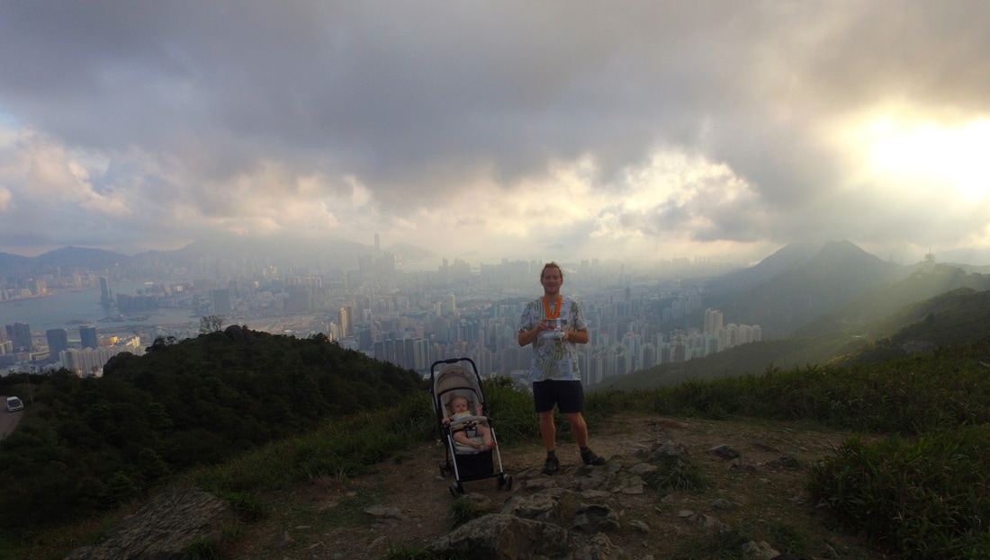
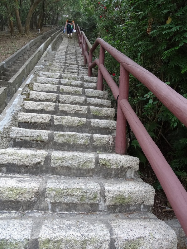
Even babies can come up :)
The whole walk should take the best part of three to four hours. Be sure to bring a few snacks and plenty of fluids for consumption along the way as there are no facilities up there. If you are feeling lazy or want shorten the duration, it is possible to cycle, drive or take a taxi up Fei Ngo Shan Road instead.
 
Tate’ Cairn is a classic year round spot that anyone can have a crack at, yet one with detours that will keep even the most seasoned of hikers more than honest. Its enchanted forests below and spectacular vistas above will no doubt leave one wanting to revisit.
4 Comments

​ADVENTURE INTO TOLO HARBOUR  -Plover Cove Reservoir and beyond

11/11/2016

0 Comments

 
Picture
Picture
If you fancy exploring a natural world that most folk don’t know about within Hong Kong, then a day trip out to Plover Cove Reservoir could be in order. The area is easily assessable via public transport and totally worth the effort to reach. Nestled amongst rolling hills and the gateway to the eastern expanses of Tolo Harbour and Double Heaven. Begin the trail at Tai Mei Tuk and venture out into the wilds of northeastern Hong Kong and discover hidden gems that lie within. Once there, you certainly won’t be in a rush to leave.
 
Getting to the start point can take a little time from HK Island and Kowloon, but it is a relatively hassle free trip. Having reached Tai Po Market via MTR, you can either catch the 20C minibus, 75K KMB bus or alternatively grab a cab for around $70 to reach Tai Mei Tuk. Before you shoot off, a quick stop for a bite to eat and stocking up on refreshments in Tai Mei Tuk could be a good idea as there are no facilities out on the trail.
 
Once refreshed and all set to go, make your way towards the water sports center and continue up the small road until you reach the lake. Greeted by the sight of the dramatic 2-kilometer long dam wall, Plover Cove Reservoir is a very impressive structure. The world’s first ‘at sea level’ fresh water reservoir, construction on Plover Cove Reservoir began back in 1960 amid disputes with China over Hong Kong’s water supply.
 
Walking the dam wall is often a relaxing experience; one of solitude and tranquillity as you emerge into the open spaces and dazzling waters of Tolo Harbour. On a weekday or public holiday, the promenade is abuzz with folk enjoying the outdoors in many fun ways; whether it is windsurfing and kite surfing out on the water, or casting a line from sure in the hope of landing fish. Watch out for manic cyclists and kite flyers too! Once at the far end of the dam wall you will meet a small island in the middle of the harbour, turn left and continue through the gate.
 
Once on the other side of this obstacle, you leave the cyclists and most others behind and start to venture into the heart of the route. Keeping the calm turquoise waters of the reservoir on your left and the darker more rugged seas on your right, the road twists and turns its way around scenic nooks before traversing a few smaller concrete dams. After this the hiking trail begins in earnest, rising and dropping many a time of small hills, every one more dramatic than the last. From here on in, it is really left to your discretion how far you wish to venture before turning back.
 
For the more intrepid types who wish to do the entire circuit around Plover Cove Reservoir or venture towards Double Heaven, the trail over the hills to Wu Kau Tang or Double Heaven, will take a long full day of hiking to achieve this. However, it is a very fulfilling one for those who are up for the challenge. The approaching winter months do lend themselves more to undertaking such distances, but make sure you are thoroughly prepared! I would recommend beginning at Wu Kau Tang instead of Tai Mei Tuk. There is an infrequent, but reliable minibus service (20R) running there from Tai Po Market MTR. This way, if you are circumnavigating the lake, it is nice to finish at Tai Mei Tuk where there are plenty of amenities and transport options. From Tai Mei Tuk, one can return to Tai Po and the rest of HK more or less the same way they entered.
 
Overall, this is an adventure for all. A safe and pleasant excursion catering to the needs of families, yet one that is engaging and flexible enough to challenge the most intrepid outdoor adventurers in HK. These approaching winter months are ideal for such activities, so there is no better time get out and explore the open spaces in this stunning part of the territory. 

0 Comments

Relaxed Lakeside Vibes At Tai Lam Chung

4/10/2016

0 Comments

 
Picture
​The western New Territories is not necessarily synonymous with natural wonders, however there are some hidden gems out there that are worth uncovering. 
 
If you fancy exploring a natural world that most folk don’t know about within Hong Kong, then a day trip out to Tai Lam Chung Reservoir could be in order. Located in the hills between Tsuen Wan and Tsuen Mun, it is a region that is as much unknown as it is remote. However, the area is easily assessable via public transport and totally worth the effort to reach. Life moves at a different pace here, the locals are as relaxed as they come in HK. It rubs off quickly and once there, you certainly won’t be in a rush to leave. The area has abundant family friendly walks and for the more intrepid, one can venture into higher peaks of Tai Lam and Tai Mo Shan Country Parks.

​The simplest way in (other than driving) is to head into the western New Territories on the MTR West Rail Line, disembarking at Tuen Mun Station. From there, one can ride the number 43 minibus that departs roughly every 20 minutes or catch a taxi to ‘So Kwun Wat Tseun’. Hop off the bus at the end of its route and continue along the sealed road in a northerly direction. Walking in is easy going on a sealed access road.
Picture
Passing through tranquil surroundings and a few small farms, you soon climb up to Tai Lam Chung Reservoir. Built in 1957, the Reservoir is often referred to as ‘the lake of a thousand islands’. Once an open valley with many small hills, now flooded it has created a stunning freshwater archipelago that sets it apart from all other reservoirs in Hong Kong. This lake became the focal point of Tai Lam Country Park upon the parks creation in 1979 and her shores serve as a good starting point for many different walking routes. The easiest of these circumnavigates the reservoir and provides a scenic stroll, suitable for families. Simply follow the Maclehose Trail Stage 10 and walk a return route to So Kwun Wat, or finish in the nearby village of Tai Lam Chung Tsuen. For those who fancy more of a challenge, then there are various trails up and over the surrounding hillsides offering superb vistas over Tai Lam Country Park and across the sea to Lantau in the south. Additionally there are a few watercourses flowing into the reservoir that feature a few small waterfalls to check out.
 
Walking around the lake can take anywhere from one hour to an entire day depending on your route, so it’s a fairly flexible place to visit making it suitable for the warmer months of late summer and early autumn. If visiting later in autumn, keep an eye out for the lovely red and orange shades of the many maple trees in the area. Once a part of Hong Kong that suffered from a lot of erosion, the last five decades have seen the area transformed amid mass afforestation.
Tai Lam
​Return travel is fairly simple, more or less the same way as when you came in from So Kwun Wat. Unless you complete the route all the way around the lake, then you can find transport at Tai Lam Chung village to Teun Mun or the HK Gold Coast.
 
This far-flung corner of HK has an incredible amount on offer for those who enjoy venturing into the wild; a day trip here serves up an insight into Hong Kong’s past and the full scope of her landscape. Escaping to Tai Lam Chung provides a peaceful retreat for those wishing to find space for reflection or satisfy a burning urge of wanderlust.
0 Comments

Monkey  Business 

6/7/2016

0 Comments

 
​IN THE JULY ARTICLE OF OUR MONTHLY COLUMN IN SAI KUNG/SOUTHSIDE/EXPAT PARENTS MAGAZINES; WE CHECK KAM SHAN 'MONKEY MOUNTAIN' 

Tucked away in the hills behind Kowloon lies a hidden wealth. Amongst picturesque landscapes shrouded in thick jungle, interspersed with azure lakes lies the domain of Hong Kong’s wild chiefs. This is Kam Shan, realm of the monkey.
Picture
​Located between northwestern Kowloon and Sha Tin, Kam Shan Country Park is indeed synonymous for its populations of wild monkeys. However, the area has plenty of other attractions to offer folk from all walks of life. For the more relaxed visitors to the area, it possesses are several custom made nature and family trails. These showcase the very best of the regions scenery and the great diversity of HK’s wildlife. Then for the more intrepid, there are many options for more exciting hiking and mountain biking trails running out of Kam Shan. One superb aspect of Kam Shan Country Park is its proximity to the city and the accessibility that comes with this. The most common way to get into the area is by catching the number 81 KMB bus from Nathan Road (This bus can also be ridden in the opposite direction from Tai Wai), disembarking at 
Shek Lei Pui Reservoir stop. For those that have a private vehicle at their disposal, this is a really neat spot to visit as one can venture into the heart of the park with their car. Drive up Tai Po Road and turn off at Kowloon Reservoir, you can then drive across the reservoir dam wall and into the heart of the country park. Make sure to wind up your windows though, or else you may incur a few extra passengers, especially if you have food!

​Arriving at the bus stop, you will soon be confronted by many monkeys, invariably a troop of Rhesus Macaques. Although the Rhesus species is native to Hong Kong, the macaques found today are believed to be re-introduced. In the 1910’s during the construction of Kowloon Reservoir, the apes were deployed to the surrounding areas in order to combat the spread of a fruit that tainted the water supply. They can roam in large numbers and enjoy the area around Tai Po Road, as the rubbish bins and increased human presence provides the chance of finding a meal. There are signs at the park entrance spelling out the dos and don’ts in regards to the monkeys. From experience, simply be relaxed. Don’t approach the monkeys with food and they will mind their own monkey business. Direct eye contact and sudden movements won’t endear you to them either. With those unpleasantries out of the way, the monkeys are great fun to watch and can be extremely photogenic!​
Picture
​​Heading into Kam Shan Country Park, simply follow the concrete access road into the woods, then across the Kowloon reservoir dam wall. From here there are several cool options to choose from, the most enjoyable one being a walk up to the monkey mountain. Follow the road up the hillside for twenty minutes or so and one will reach a picnic area, usually full of macaques. The monkeys here are a little less feisty than those on Tai Po ​road and seeing them in their natural treetop habitat is a delight.
Although you’re not supposed to feed the animals, some people do. As a result, the monkeys will approach you if you have food and there is also a lot of wild boar in the area. The boars are harmless and are a real treat to spot. On the way to the top of the monkey mountain there is also the Kam Shan Family Trail, which makes for a pleasant detour. Back down beside the Kowloon Reservoir, you can also leave the road to explore the Kam Shan Tree Walk. This consists of a well signposted pathway leading to Shek Lei Pui and back, highlighting the many different types of flora and fauna along the way. For those who wish to head further a field, there are extensive networks of mountain biking trails running out of Kowloon reservoir to the west. If you’re a hiker, there is a lot on offer in many directions. The best route to do in my opinion is to follow the Maclehose Trail eastwards and hike up towards Lion Rock.
Picture
Heading back from the country park is equally simple as finding your way in. In addition to taking the bus or driving, there are plenty of taxis on Tai Po Road to flag down.
 
You’ll very quickly descend back into the city and that monkey mountain will seem a million miles away. A world of dense rainforests guarded by troops of charismatic macaques. Yes, in Hong Kong!
0 Comments

TSING YI –The isle of bridges 

3/5/2016

2 Comments

 
​IN THE MAY ARTICLE OF OUR MONTHLY COLUMN IN SAI KUNG/SOUTHSIDE/EXPAT PARENTS MAGAZINES; WE EXPLORE THE ISLAND OF TSING YI AND EXPOSE SOME EXCITING HIKING LOCATIONS THAT ARE LARGELY UNKNOWN IN HK

Once remote and untouched, the island of Tsing Yi is anything but nowadays. Located to the northwest of Hong Kong Island and south of Tsuen Wan, the island has become a major transport hub and commuter base. Many of us pass through on a regular basis, but most overlook the island as a destination due to its urban appearance. A hotspot for infrastructure, the creations that mankind has erected around these parts is the stuff of civil engineering dreams! Nevertheless, for all the construction of recent decades, Tsing Yi still possesses some surprisingly secluded areas, peppered with nature walks and stunning viewpoints to accompany them.
 
Tsing Yi's name literally means "green clothes", but the island actually got its name from a type of fish once abundant in nearby waters. Before the Tsing Yi South Bridge was built in 1974, the old Tsing Yi pier was the only link between the island and the outside world. Fast-forward to today, the island is now home to about 200,000 people and is connected by eight bridges all around the island. This includes the Tsing Yi and Stonecutters Bridges, respectively the largest and third largest of their kinds in the world!
Tsing Yi Hike
There are a couple of fantastic short to mid length walks around the rural parts of the Island, offering a range of experiences from an easy going family stroll, to challenging assents. Either way, you’re guaranteed a peaceful retreat from city life, epic bridge vistas and fresh air.
 Option 1, Tsing Yi Nature Trail (Easier)
Covering the western hills of the island, the Tsing Yi Nature Trail offers an easy going, family friendly option. The network of paved paths is well mapped and signposted throughout. Peppered with exercise areas, pavilions and viewpoints, it suits those who desire an accessible and flexible route. From end to end, the trail is approximately 3km in length and is done within an hour if you stay on the move. I recommend taking your time to follow some of the detours along the way and admire the stunning views over the Tsing Ma Bridge and out to Lantau. The most convenient way to reach the trailhead via public transport is to hop off the MTR at Tsing Yi Station and ride the 248M bus to the last stop, from there 10 minute stroll up Liu To Road will get you to the start of the trail network. Alternatively, you can walk straight to the trails from the MTR; this will take around half an hour.

Tsing Yi Hike
Option 2, Sam Chi Heung (Harder)
For the more adventurous folk out there, climbing up Sam Chi Heung is an awesome option. The route is direct and prominent, gaining a few hundred meters of elevation above all the surrounding areas. The three summits of Sam Chi Heung are not as heavily forested as the Tsing Yi Nature Trail, thus providing uninhibited panoramas over Tseun Wan, Kowloon and HK Island. But undoubtedly, the main attraction of climbing Sam Chi Heung is the unique vantage point it provides to look over the Stonecutters Bridge and Hong Kong Port. Find the trailhead located beside Cheung Ching Bus Terminus and follow it past some football/soccer pitches. You will start to ascend and not before long, reach a large burial area scattered across the hillsides. Once atop the first peak, it’s worth continuing along the trail until you reach the third peak, as this is where the best views are to be had. The simplest way down is a return to Cheung Ching Bus Terminus. However, for the really adventurous folk out there, keep an eye out for ribbon marked alternate routes down.
Tsing Ma Bridge
​If you ever wish to stop and take in views of the Tsing Ma Bridge without having to go hiking, the Lantau Link Visitor Center could be worth a visit. Open every day other than Wednesday, the center can be reached by public transport via the 308M minibus from Tsing Yi MTR. Taxi and by car are also great ways to reach this location.

If you’re really enthusiastic, both walks can be done together as a day hike. What is great about all of these itineraries on offer is the ease of return to public transport and other amenities. That is the beauty of venturing out in a place such as Tsing Yi (and Hong Kong in general for that matter); after working up a sweat out and about, you can soon find respite. This accessibility is certainly one of Tsing Yi’s main draw cards, a tremendous place to visit on a whim without premeditation. But once you have arrived and got under the skin of this dramatic isle, the rugged hillsides and ‘bridgetastic’ vistas will sell themselves. A trip through Tsing Yi will never feel the same, after coming to truly appreciate this underrated area of Hong Kong.
2 Comments

PEAK  HOUR

12/4/2016

3 Comments

 
IN THE APRIL ARTICLE OF OUR MONTHLY COLUMN IN SAI KUNG/SOUTHSIDE/EXPAT PARENTS MAGAZINES; WE HEAD OVER VICTORIA PEAK IN SEARCH OF HIDDEN GEMS

Victoria Peak. You may have heard of it... Yes, Hong Kong is for many of us our home and long time residents may question the value of me telling you about visiting such a well-publicized area. However, it is packed full of lesser-known nooks and possesses bountiful options for exploration. I must admit, until recent times ‘The Peak’ was a spot I would only frequent when showing visiting friends around town and I never went there on my own. Since I have been back in HK and I am hiking a lot more these days, I have taken more time to explore this region of Hong Kong Island and have been thoroughly impressed with what I have found!
 
With such a plethora of options I’ll keep things simple here, sharing with you my favorite route over The Peak and highlighting a few appealing detours along the way. My optimal route begins in Admiralty, runs over Victoria Peak and finishes in Aberdeen.
Picture
Now as a local, I am aiming to walk the entire way up and over. But of course, there are no rules and if you want to take it easy or you’re short on time, half the route can be done on foot and the other by alternate means of transport. I love starting my adventure in the city and finishing in more tranquil surroundings on the southern side of HK Island. Beginning in Admiralty, one should proceed up the hill to the Hong Kong Botanical and Zoological Gardens if ascending on foot (otherwise catch the number 15 bus or a taxi from Queensway to the Peak Galleria, don’t bother queuing for the tram up).
 
Passing through the botanical gardens, one immediately escapes the hustle and bustle of Central, the gardens contain many interesting bird and marsupial enclosures and I love having a wonder around before pressing onwards and upwards. Ascending Old Peak Road, the gradient steps up a notch. The going gets much more physical, but a glance over your shoulder reveals an increasingly expansive view of the skyscrapers and motivates you to carry on. Once above all the housing developments, Old Peak Road transforms into a charming laneway. A smooth surface winding its way through the trees, the shady shelter harbors many native bird species, their calls providing a soothing soundtrack for the final uphill section.
Picture
Once at the Peak Tower, one has the option to climb further to the summit of Mt Austin or to do the circular route around The Peak, both of these I recommend if you want to loose the crowds and see some views. After a stop for ice cream or to reload your water bottle, the more adventurous leg of the walk begins. Heading south, most folk may head down the trail that leads to Pok Fu Lam Reservoir and Pok Fu Lam Road. This route is pleasant but short, so if you have a bit more time to spare, try heading down the ‘Peel Rise’ towards Aberdeen.
 
Walk along Peak Road for a couple hundred meters and over the small the small arch bridge onto Gough Hill Path, the Peel rise will then be on a turning down the hill to your right. Heading down the Peel Rise, it is a similar vibe to heading up the later stages of Old Peak Road. Densely forested and relaxing, stroll down without a care in the world, Hong Kong suddenly becomes an exceedingly long way away indeed.
Half an hour or so down and one will find themselves at the end of the Peel Rise where they can turn right and arrive in Aberdeen. I recommend turning left and taking a detour to explore the Upper & Lower Aberdeen Reservoirs. This area flies under many people’s radars, yet is incredibly scenic and the large dam wall at the upper reservoir alone is worth the walk to visit.
 
Back down in Aberdeen and a timely return to civilization. The whole walk should take between 2 to 5 hours depending on your pace and choice of route. There are plenty of dining options here for a post hike meal here, or simply shoot back to wherever you want on a bus or taxi. The MTR opening in Wong Chuk Hang later this year will be a game changer for the area.
 
This is a versatile itinerary that can satisfy all folk, from families in search of a spot of fresh air, to athletic individuals seeking an after work workout. One way or another, heading up Victoria Peak is a must do for anyone spending time in our great city. That magical view from the top never gets old. ​
Picture
3 Comments

SheK Pik - Tai O, Southern Lantau Adventure

13/3/2016

0 Comments

 
IN THE MARCH ARTICLE OF OUR MONTHLY COLUMN IN SAI KUNG/SOUTHSIDE/EXPAT PARENTS MAGAZINES; WE VENTURE OUT TO THE REMOTE SOUTHERN TIP OF LANTAU ISLAND FOR A MEMORABLE ADVENTURE​
 
There are many spots in Hong Kong that can feel far removed from the city, but are in fact just round the corner or over the hill from town. Then, there are those rare confines that are genuinely far removed from civilization. The Southern tip of Lantau Island is such a place. Take the time to venture this enclave and you will be rewarded with a trip back in time! An untarnished landscape bursting with deserted beaches, fertile valleys and lush jungles lying in wait.
Lantau Hiking
Despite Southern Lantau’s geographical isolation from the rest of Hong Kong, it is easily accessible and can be reached from the city within a couple of hours. Once there, Southern Lantau is best explored by foot. My favorite route here follows the regions inspiring coastline, starting at Shek Pik in the east and finishing at Tai O in the west. As a direct hiking route, the more athletic types can complete the 15 kilometers within 4-5 hours. However, there are many sights worthy of a cheeky detour along the way and it is worthwhile dedicating an entire day to this adventure. As a coastal hike, the main path avoids any major hills and is ideal for families who enjoy the outdoors. It is advisable to bring a map along if unsure of your directions and plenty of fluids during the warmer months.
 
To reach the start of the trail, catch either the ‘number 11’ bus from Tung Chung, or ‘number 1’ bus from Mui Wo to Tai O. Keep an eye out for Shek Pik Reservoir and disembark at the first bus stop immediately after crossing the dam wall. Take in the beautiful sight of Shek Pik Reservoir and Lantau Peak behind before turning away and following the Lantau Trail south. The first part of the walk follows a catch-water and serves as a gentle warm up before hitting the dirt track. Staying up above the coastline, there are beautiful views to be had across many bays and beaches on this section.
 
The path then descends to the idyllic Fan Lau Peninsula and its two sandy beaches. There is a small dai pai dong here with a friendly owner that will do you a wholesome bowl of noodles, complete with drinks and fruit. This is the only such facility along the way, so make sure to recharge here before heading on. If interested in historical sites, one can take a half hour excursion to visit Fan Lau Fort on the far end of Fan Lau Peninsula. Built in 1729 during the reign of the Yongzheng Emperor, the fort was subsequently abandoned by the British in 1898 and a large stone rectangle is most of what remains today.
 
The second half of the walk from Fan Lau to Tai O follows a much more sheltered section of coastline and is more heavily forested. The area possess great biodiversity, so keep an eye out for interesting plants and animals. Pass through the majestic village of Yi O; complete with agricultural farmland, grazing cattle and abandoned buildings, it’s an exceptionally surreal settlement to stroll through.
 
Shortly after passing through Yi O the path meets an area of mangroves on the coast, at this juncture there is an option to check out the most stunning of detours at the Man Cheung Po waterfalls and infinity pool. Turn right onto a less distinct path and follow your way up the hill past a few abandoned houses. Continue for around 20 minutes up the valley until you reach the pools. It’s quite a popular spot nowadays, so you may suddenly see more folk in the first five minutes up there than you would have on the entire walk to that point. But upon reaching the pools on a sunny day, it is clear to see what all the fuss is about. Although it is prohibited to swim in the infinity pool (as it serves as a reservoir for Tai O), the numerous rock pools and waterfalls behind it are fair game. Go back down the same way you came up and upon returning to the main path, it’s a simple walk for one hour to reach Tai O.
Hong Kong Wildlife
Additionally, if hiking 15-17 kilometers sounds like biting off more than you can chew, there is always the option to hike either end of the trail as a shorter return from Shek Pik or Tai O, to Fan Lau and Man Cheung Po/Yi O respectively.
 
Once in Tai O, it’s always good to have a wonder around the village, no matter if it’s your first or one hundredth time there. Enjoying the sights and a refreshing beverage always go down a treat after a decent walk. From Tai O you can simply hop on the bus back to civilization, although beware that the ‘number 11’ bus to Tung Chung can sometimes have massive queues during holiday seasons. If this happens, then I strongly recommend cutting your losses by opting for the ‘number 1’ bus to Mui Wo and an onward ferry to Central.
 
Southern Lantau is such an incredible part of Hong Kong to explore. Any adventure here will leave you with a bunch of great memories and a sound nights sleep! 
0 Comments

Ng Tung Chai January adventure

24/2/2016

0 Comments

 
WE WENT FOR A GREAT TOUR UP TO NG TUNG CHUNG CHAI THE OTHER MONTH. CHECK OUT RANDEE'S AWESOME BLOG POST ON HER TIME IN HK WITH US!

https://loveelisike.wordpress.com/2016/02/20/dance-in-the-rain-how-about-a-hike-part-2/
Picture
0 Comments

Tung Lung Chau -the wild column

7/2/2016

0 Comments

 
IN THE FEBRUARY ARTICLE OF OUR MONTHLY COLUMN IN SAI KUNG/SOUTHSIDE/EXPAT PARENTS MAGAZINES; WE VENTURE OUT TO THE RUGGED ISLE OF TUNG LUNG CHAU FOR A MEMORABLE ADVENTURE

Picture
​Rugged, windswept and diverse, Tung Lung Chau possesses a little bit of something for everyone. From family friendly outings and historical rekeys, to rock climbing and zip lining sessions, this craggy outcrop has all the tricks to keep you more than entertained for the day! Easily reached, it makes for a convenient full or half day trip away from the city.
Picture
To reach the island, take a ride on the ferry from Sam Ka Tsuen Public Pier in Yau Tong (5 mins walking distance from Yau Tong MTR Station). Several sailings make their way to Tung Lung Chau each day until 4:30pm; visit bit.ly/TungLungChauFerry for the complete ferry schedule. Make sure to check out climatic conditions on the day before venturing onto the water. If the weather is wild, it may not make for the most pleasurable of experiences, but on a fair day the island and its surrounds are simply stunning. Departing adjacent to the picturesque Lei Yue Mun Village, the ferry then embarks across the open waters of eastern Victoria Harbour. There are brilliant views across the Clear Water Bay Peninsula to the north and to Shek O Peninsula to the south.

Half an hour on board the ferry flies by and Nam Tong ferry pier soon comes into view. Once ashore, you’re greeted by an enticing selection of route options. For those who fancy either a relaxing day out or desire to cut out the fuss and be thrust straight into the action, hang a left at Nam Tong following signs for Tung Lung Fort. A twenty minute stroll from this juncture takes one directly to the eastern side of the island. For the more intrepid traveler, a longer walk around the island may suit. There is an 8.5km route circumnavigating Tung Lung Chau that takes around 4 hours to complete and is best experienced in an anticlockwise direction. This trail is a great way to pack in all the sights of the island, including a climb to its 232m pinnacle.
No matter which of the two routes is taken, one will arrive at Tung Lung Chau’s northeastern promontory where Tung Lung Fort is located. From here folk can get hands on with the main attractions on offer. Close to the campsite lie the remains of Tung Lung Chau Fort, built between 1662 and 1722 by order of Yang Lin, Viceroy of Guangdong and Guangxi. It used to defend the island from pirates attempting to enter Victoria Harbour from the South China Sea.
 
Climbers don’t forget your chalk bag! Regarded as one of the best places in Hong Kong for rock climbing, the eastern escarpments of Lung Tung Chau offer bountiful climbing lines in a scintillating setting. There are several operators that provide climbing and zip lining sessions here, visit bit.ly/TungLungChauGuide for more information.
Picture
Be sure to catch the final boat leaving the island for return to the mainland at 5pm, unless an overnight stay is more your cup of tea. Camping in HK can be an awesome experience and Tung Lung Chau is a superb illustration of this. The campsite beside Tung Lung Fort has adequate facilities and a rugged waterfront setting to die for. Weekends and public holidays can be busy here so be wise with your timing, try not to visit on a public holiday. If you have a bit of time to kill before the next ferry departure, perhaps make a detour to see Hong Kong’s oldest and largest rock carvings, dating back over 5000 years the dragon depiction is a relic worth seeing. Alternatively, relax at one of the islands several dai pai dongs (local cafes).
 
All in all, this is a cracking little spot that all can to enjoy in different ways. Among the list of Hong Kong’s many islands, Tung Lung Chau flies under the radar and punches well above it’s weight.
0 Comments

GET YOUR HEAD TORCHES READY! 

27/1/2016

0 Comments

 
Lantau Sunrise
We've added an exciting new route to our list of set hiking tours!!! One of our favorite places to go in HK, we've done this a few times as a customised hike and want to share the experience with more people.
On a good day, witnessing the sunrise atop Lantau Peak is a gift to behold. When the weather is good, get involved!
​
http://www.wildhongkong.com/lantau-peak-sunrise-climb.html
0 Comments
<<Previous
Forward>>

    Categories

    All
    Beaches
    Boating
    Camping
    Cycling
    Generic
    Hiking
    HK 5 Trails MTB
    HK Island
    Islands
    Kayaking
    Lakes
    Lantau Island
    Lion Rock
    Mountain Biking
    Ng Tung Chai
    Rainforest
    Sai Kung
    Waterfalls
    Wildlife

    Picture

    About us

    We are one of Hong Kong's premier adventure & eco tour operators. This is our blog, documenting many of the wild places we explore and show guests.

    RSS Feed

    Archives

    September 2024
    June 2024
    May 2024
    April 2024
    December 2022
    November 2021
    October 2021
    September 2021
    June 2021
    May 2021
    March 2021
    January 2021
    December 2020
    November 2020
    October 2020
    September 2020
    June 2020
    April 2020
    March 2020
    February 2020
    October 2019
    September 2019
    August 2019
    July 2019
    May 2019
    May 2017
    April 2017
    February 2017
    January 2017
    November 2016
    October 2016
    September 2016
    August 2016
    July 2016
    June 2016
    May 2016
    April 2016
    March 2016
    February 2016
    January 2016
    December 2015
    November 2015
    October 2015
    September 2015
    August 2015
    July 2015
    June 2015

FAQs
GENERAL REQUIREMENTS
TERMS & CONDITIONS

Whatsapp / Phone +852 6025 3862  
​Contact Us 

Copyright © 2015-2025  Wild Hong Kong 
  • Home
  • Our Guided Tours
    • Hiking Tours >
      • Easier Classic HK Hikes >
        • Dragon's Back Trail
        • Victoria Peak (The Peak)
        • Lion Rock
      • Moderate Wilderness Hikes >
        • Ng Tung Chai Waterfalls
        • Sai Kung Deserted Beaches
        • Sai Kung Geopark Coastal Hike
      • Challenging Hikes >
        • Ma On Shan Climb
        • Wong Lung Hang Stream Trek
        • Lantau Peak Sunrise Climb
    • Cycling Tours >
      • Wetlands Cycle
      • Tolo Harbour Cycle
      • Plover Cove Cycle and Hike
      • Tai Lam Mountain Biking
    • Kayaking & SUP Tours >
      • Geopark Kayaking ​(Beginner / Intermediate Level)
      • Geopark Kayaking Sea Arches (Advanced Level)
      • Hoi Ha Kayaking
      • Sai Kung SUP
    • Events, Programmes & Team Building
    • School Holiday Adventure Programmes >
      • Kayaking - 5 Day Programme
      • Mixed Activities - 5 Day Programme
      • Hiking & Stream Trekking - 5 Day Programme
    • Gift Vouchers
  • Book A Tour
  • About us
  • Merchandise
    • Clothing
    • Hats
    • Accessories
  • More
    • Blog
    • Media
    • Weather Forecast
    • General Requirements
    • Terms and Conditions
    • FAQs
    • Contact Us
  • 🌐
    • 中文
    • English
    • Français