|
There is a bountiful array of wild places to explore in Hong Kong, some more remote and some more accessible than others. Our list combines the best of both on offer in HK, with all offering respite along the way from the summertime heat. All the places below we offer customised tours to. East Dam & Long Ke (East Sai Kung Country Park) –Beaches, Cliff Jumping, Hiking, Kayaking, Rock Climbing WILD FACTOR- ★★★★☆ Venturing into the wilds of Sai Kung, the plethora of options open to adventures is astounding! The East Dam is a great launch pad from which to mount an expedition. Coming in, the drive around the azure waters of High Island Reservoir makes for a scenic introduction. Upon arrival at the east dam one can venture in a couple of directions; either head down the slope to the dam wall and Geopark beyond, or follow the Maclehose trail northwards. The Geopark is rugged and truly wild. Littered with islands, caves and hexagonal rock formations, there are many opportunities for the more intrepid of folk to enjoy some fishing, climbing & cliff jumping. Following the Maclehose Trail in the opposite direction, one can explore arguably the most Idyllic beach HK has to offer in Long Ke Wan and some extraordinary hiking routes over to Sai Wan and beyond. Getting there: Having reached Sai Kung, grab a cab out to the East Dam of High Island Reservoir for around $120. Returning from the East Dam, a taxi is again the best option instead of walking. From Sai Wan, one can hike up to the road or take a boat back to Sai Kung. If hiking back remember to check the 29r bus timetable or call for a taxi in advance, as mobile reception in that area can be fickle.
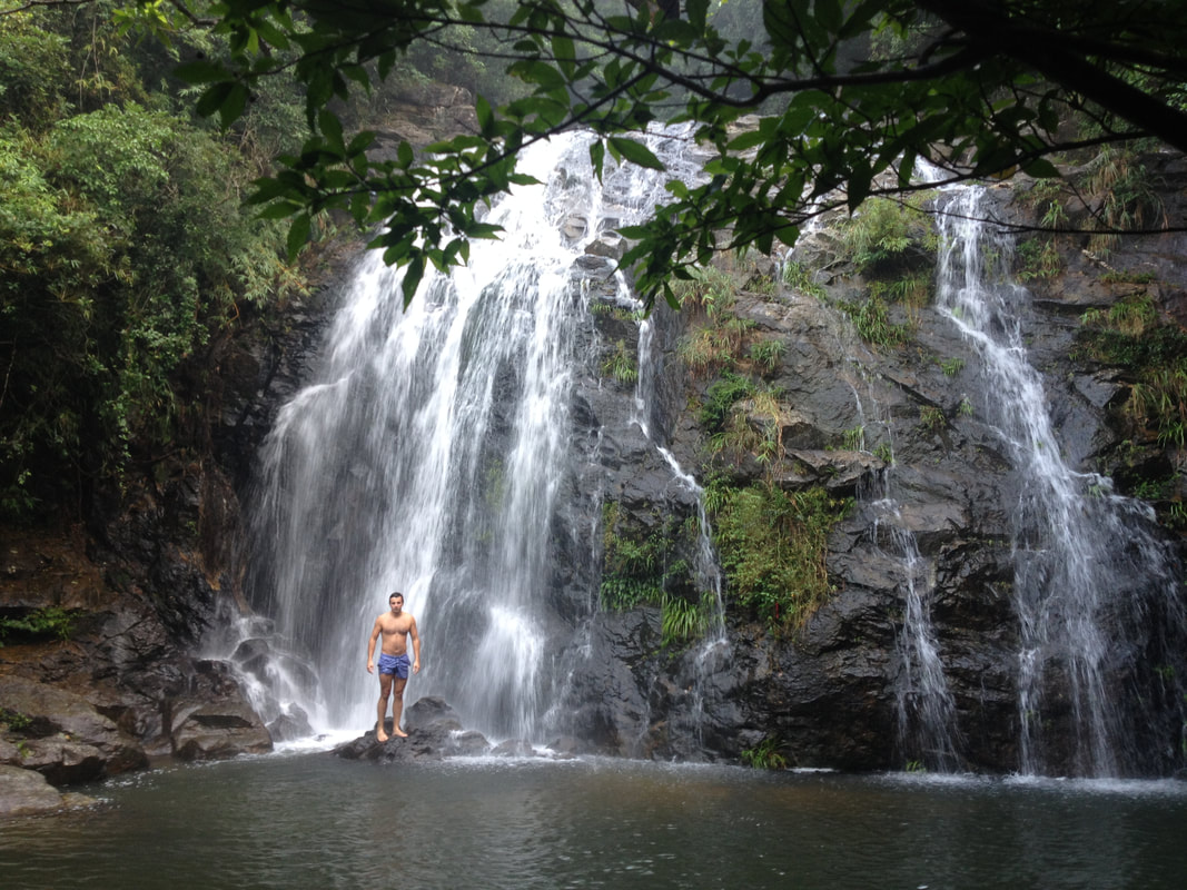
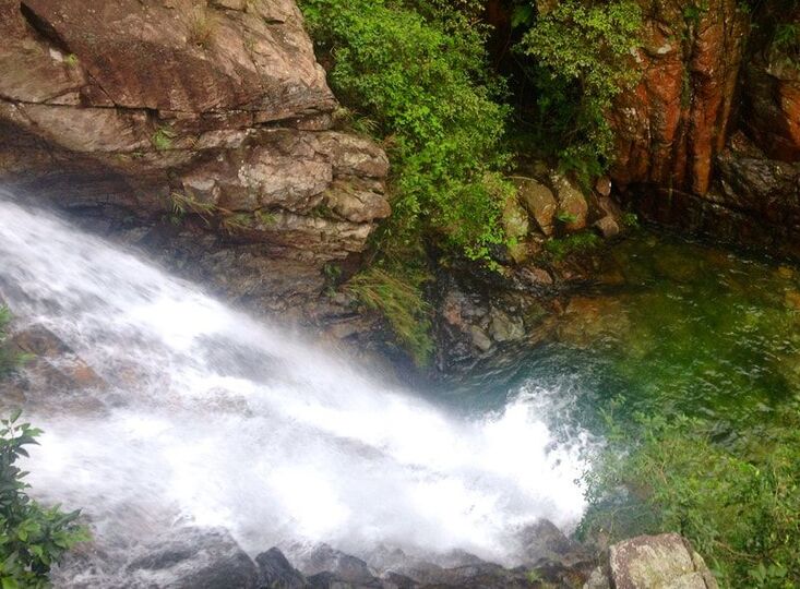
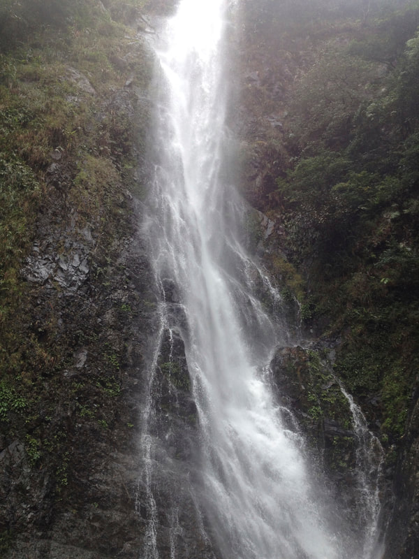
An untarnished landscape bursting with deserted beaches, fertile valleys and lush jungles lying in wait. Getting there: To reach the start of the trail, catch either the ‘number 11’ bus from Tung Chung, or ‘number 1’ bus from Mui Wo to Tai O. Keep an eye out for Shek Pik Reservoir and disembark at the first bus stop immediately after crossing the dam wall. Take in the beautiful sight of Shek Pik Reservoir and Lantau Peak behind before turning away and following the Lantau Trail south. Additionally, if hiking 15-17 kilometers sounds like biting off more than you can chew, there is always the option to hike either end of the trail as a shorter return from Shek Pik or Tai O, to Fan Lau and Man Cheung Po/Yi O respectively. Ping Nam Stream (Pat Sin Leng Country Park) –Cliff Jumping, River Walk, Waterfalls WILD FACTOR- ★★★★★ If you fancy exploring a natural world that most folk don’t know about within Hong Kong, then a day trip out to Luk Keng could be in order. Located within the innermost depths of Pat Sin Leng Country Park, it is a region that is as much unknown as it is remote. However, the area is easily assessable via public transport and totally worth the effort to reach. Nestled amongst rolling hills and the gateway to the northern parts of Pat Sin Leng Country Park, Luk Keng is truly rural. Life moves at a different pace here, the locals are as relaxed as they come in HK. It rubs off quickly and once there, you certainly won’t be in a rush to leave. From there one can venture into higher peaks of Pat Sin Leng and discover hidden gems that lie within, namely the Ping Nam Stream. A challenging route upstream with many dramatic cascades and pools along the way to take in. However, beware of slippery rocks in the wet, the use of a guide would be strongly recommended. Getting there: Make your way to Fanling MTR Station, exit A and hop on the KMB 78K Bus. After 20-25 minutes or so, hop off at Nam Chung stop and cross the main road looking for Luk Keng Road. A further 20 minutes walk and one will reach a small village, turn right here onto South Bay Road and keep going till you meet a small reservoir dam wall. Find the goat track on the right hand side, this will bypass the dam and lead you to the Ping Nam Stream. On the way back, keep an eye out for a 56K minibus. Catch this back to the MTR if the opportunity arises. Sharp Peak & Ham Tin (East Sai Kung Country Park) –Beaches, Hiking, Mountain Climbing WILD FACTOR- ★★★★☆ I think this could regarded be Hong Kong’s most remote mountain and the areas surrounding the mount are simply stunning! Although Sharp Peak isn’t massively high at 468m, it is a very prominent hill and easy on the eye. The unspoilt views from the summit are among the finest in the land. It is a steep and dramatic final ascent to the summit, but well worth the effort on a fine day. It is a top draw route deserved of top draw conditions, so save this one for the best weather available (clear skies, high visibility). Get up there for sunrise/sunset if you can. Be warned, that this is a tough route in the warmer summer months! Getting there: From Sai Kung town, take the 29R village bus or $100 taxi to Sai Wan Pavilion. Walk for an hour to reach Sai Wan and then a further hour in a northerly direction along the beaches of eastern Sai Kung Country Park. Dominating the landscape, Sharp Peak will often be in view. The simplest way to ascend is to take the direct route up the mountain ridge from the northern end of Tai Long Beach. Heading down there are a few options route wise, either returning via Sai Wan or following Mclehose Trail section 2 towards Wong Shek Pier and catching a bus from Pak Tam Road. This route can be done in either direction. Yellow Dragon Gorge (Lantau North Country Park) –River Walk, Waterfalls WILD FACTOR- ★★★★★ Hidden away within the depths of Lantau Island is the Yellow Dragon Gorge, a secluded oasis away from all the hustle and bustle. Boulder by boulder, one ventures upstream into a vertical landscape. Surrounded by cliffs and waterfalls, you would not believe you're in Hong Kong. The adventure culminates at the end of the gorge where three massive cascades fall down onto you from high above! Be aware that this route is of a technical nature, requiring jumping between stones on the river and bouldering in places to reach the upper waterfalls. The use of a guide would be strongly recommended. Getting there: Make your way to Tung Chung MTR station and from there; walk through the estates of Tung Chung Town to Wong Lung Hang Road. Follow the paved road all the way to the end and find the river on your left. Venture as far upstream as you dare.
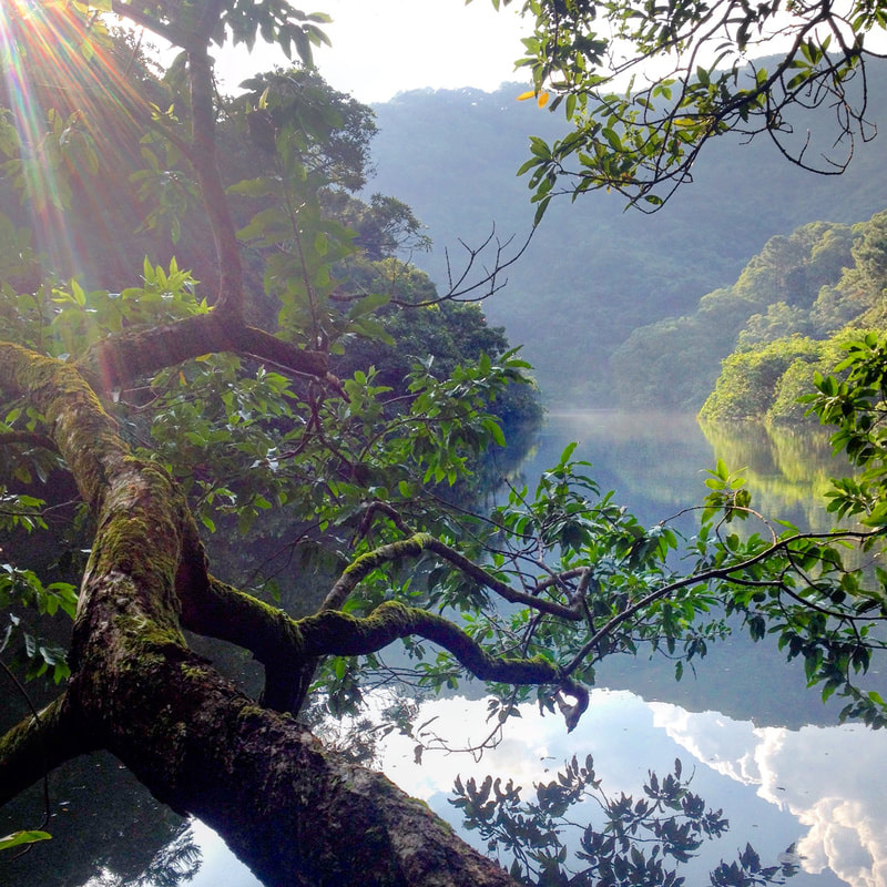
Life moves at a different pace here, the locals are as relaxed as they come in HK. It rubs off quickly and once there, you certainly won’t be in a rush to leave. From there one can venture into higher peaks of Pat Sin Leng and discover hidden gems that lie within. It’s perfectly feasible to walk the lakeside loop in a clockwise direction, but the anticlockwise adventure makes for the best experience and simplest navigation. Getting there: The simplest way in (other than driving) is to head into the northern New Territories on the MTR East Rail Line before disembarking at Fanling Station. From there, one can catch the 52B minibus that departs roughly every 20 minutes. Hop off the bus at Hok Tau Wai and make your way to the t-junction in the road. Continue along the sealed road in a southerly direction following signs for Hok Tau Reservoir. Walking in is easy going on a sealed access road. The imposing ranges of Pat Sin Leng become ever nearer and before you know it you’re in amongst the rocky peaks. After rising up, one reaches a dam wall and the impressive panorama of the lake held behind is unveiled; from this point onwards the adventure begins in earnest, following signs for the ‘Hok Tau Family Walk’.
Getting there: The best way to reach Ng Tung Chai from central HK is by catching the MTR to Tai Wo Station, then descending below the station where one can either taxi or bus it up to Ng Tung Chai Village. The 64K bus runs every 15-20 minutes during the day, you can catch this to Ng Tung Chai stop and follow the sealed side road up the hill. However, I recommend hopping in a taxi on the way there as it enables you to whizz right up through the village and be deposited at the trailhead. A taxi ride only sets you back around $50HKD. Lion Rock (Lion Rock Country Park)
–Hiking, Wildlife, City Views WILD FACTOR- ★★☆☆☆ For those who thought The Peak was the most dramatic summit looming over Victoria Harbour, think again. There is a roaring lion to north. It may not be as well known, but the Lion Rock is right up there in terms of grandeur. Conquer this rugged ridge and one will witness some of Hong Kong’s finest views. Feel the intense sprawl of Kowloon and enjoy the iconic backdrop of HK Island behind. Meanwhile a gaze round the other side reveals Sha Tin Valley and the expansive hills of the New Territories. Not only is being at the top incredible, but the walking to be had either side is most enjoyable. Keep an eye out for wildlife along the way, in particular monkeys! The path will undulate for an hour until arriving at the foot of the Lion Rock. Upon the reaching the summit at 495 meters above sea level, the footpath emerges from the undergrowth to reveal unrivaled panoramas of Kowloon and its surrounds. Getting there: The route up is easily accessed from Wong Tai Sin MTR Station. Find exit E and begin climbing up Sha Tin Pass Road, stay on Sha Tin Pass Road and you shall gradually rise above the tower blocks of Kowloon. After about 45 minutes of walking, you’ll intercept the MacLehose Trail and signage for the Lion Rock Country Park on your left hand side. The return route down is fairly simple. Keep turning left at all junctions in the hiking trail and you’ll be back to civilization in an hour. The simplest way to the MTR is to turn left once reaching Lung Cheung Road and follow the highway into Wong Tai Sin. Alternatively, you can cross Lung Cheung Road and head into either Lok Fu or Kowloon Tong.
0 Comments
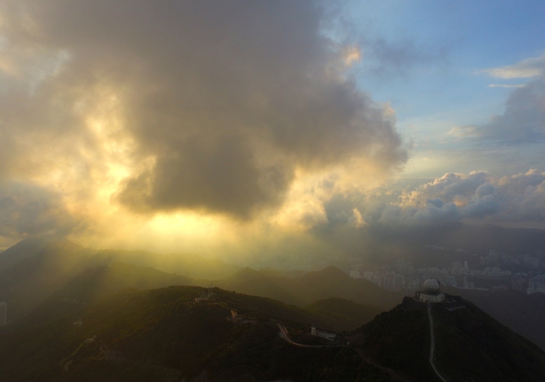
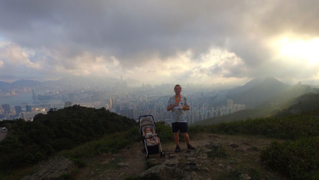
For those who thought The Peak was the most dramatic summit looming over Victoria Harbour, think again. There are some incredible vistas to the north of Kowloon. It may not be as well known, but Tate’s Cairn and the adjacent Kowloon Peak is right up there in terms of grandeur. Conquer this rugged ridge and one will witness some of Hong Kong’s finest views. Feel the intense sprawl of Kowloon and enjoy the iconic backdrop of HK Island behind. Meanwhile a gaze round the other side reveals Sai Kung Country Park, Sha Tin Valley and the expansive hills of the New Territories. Not only is being at the top incredible, but the walking to be had either side is most enjoyable.  Mid afternoons make an ideal time to set off, ensuring cooler temperatures and sunset vistas from the summit ridge. The route up is easily accessed from Wong Tai Sin MTR Station. Find exit E and begin climbing up Sha Tin Pass Road, stay on Sha Tin Pass Road and you shall gradually rise above the tower blocks of Kowloon. After about 45 minutes of walking, you’ll intercept the Wilson Trail (Stage 4). Turn right and follow the road up towards the ridge line. Walk through the lush forests of Lion Rock Country Park before emerging upon more grassy terrain. Keep an eye out for wildlife along the way, in particular monkeys. For those who want a much shorter stroll, upon reaching the junction between Fei Ngo Shan Road and Jat’s Incline, simply walk back down into Choi Hung via Jat’s Incline. Otherwise I recommend following Fei Ngo Shan Road to the mountain ridge where the Tate’s Cairn Weather Observatory is located. Upon the reaching the summit at 583 meters above sea level, the route emerges from undergrowth to reveal unrivalled panoramas of Kowloon and its surrounds. Pose for dramatic photos above large granite outcrops dating back to the Jurassic Period. Or take a perch, soaking up the relaxing vibes as skies darken and the vibrant lights from the millions below come to life. A quick dash up one of many small tracks running above the road reveals stunning natural vistas over Ma On Shan and Sai Kung Country Parks... the contrast to Kowloon couldn’t be starker. The return route down is fairly simple, but only if you want it to be. Keep walking down Fei Ngo Shan Road to Choi Hung if you want to play it safe. Otherwise, there are a few really awesome alternatives for onwards adventures and ultimately decent back to town. For longer walks, remain with the Maclehose or Wilson Trails as long as you wish. However my pick for the super intrepid is the ridge walk over Kowloon Peak, past ‘Suicide Cliff’ and down the East Face to Clear Water Bay. Be forewarned that this is a very technical and dangerous option only to be attempted by the most experienced of hikers. If in any doubt whatsoever then bring a guide with you, or at the very least do the route in reverse so that you’re climbing the trickier parts of the route. The whole walk should take the best part of three to four hours. Be sure to bring a few snacks and plenty of fluids for consumption along the way as there are no facilities up there. If you are feeling lazy or want shorten the duration, it is possible to cycle, drive or take a taxi up Fei Ngo Shan Road instead.
Tate’ Cairn is a classic year round spot that anyone can have a crack at, yet one with detours that will keep even the most seasoned of hikers more than honest. Its enchanted forests below and spectacular vistas above will no doubt leave one wanting to revisit.
IN THE JULY ARTICLE OF OUR MONTHLY COLUMN IN SAI KUNG/SOUTHSIDE/EXPAT PARENTS MAGAZINES; WE CHECK KAM SHAN 'MONKEY MOUNTAIN'
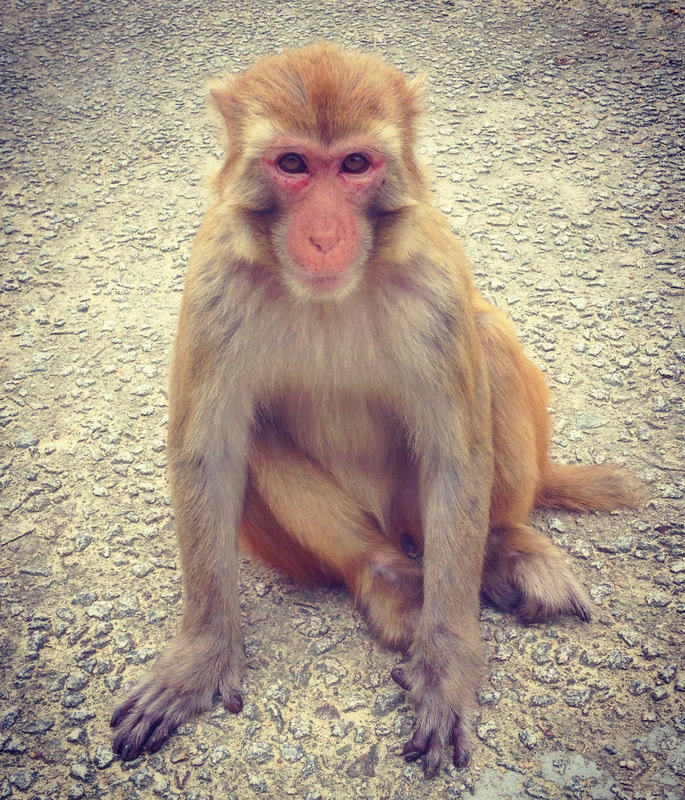
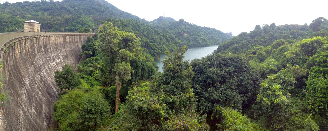
Tucked away in the hills behind Kowloon lies a hidden wealth. Amongst picturesque landscapes shrouded in thick jungle, interspersed with azure lakes lies the domain of Hong Kong’s wild chiefs. This is Kam Shan, realm of the monkey.
Shek Lei Pui Reservoir stop. For those that have a private vehicle at their disposal, this is a really neat spot to visit as one can venture into the heart of the park with their car. Drive up Tai Po Road and turn off at Kowloon Reservoir, you can then drive across the reservoir dam wall and into the heart of the country park. Make sure to wind up your windows though, or else you may incur a few extra passengers, especially if you have food!
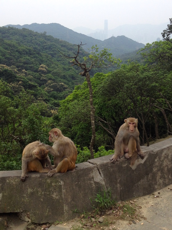
Arriving at the bus stop, you will soon be confronted by many monkeys, invariably a troop of Rhesus Macaques. Although the Rhesus species is native to Hong Kong, the macaques found today are believed to be re-introduced. In the 1910’s during the construction of Kowloon Reservoir, the apes were deployed to the surrounding areas in order to combat the spread of a fruit that tainted the water supply. They can roam in large numbers and enjoy the area around Tai Po Road, as the rubbish bins and increased human presence provides the chance of finding a meal. There are signs at the park entrance spelling out the dos and don’ts in regards to the monkeys. From experience, simply be relaxed. Don’t approach the monkeys with food and they will mind their own monkey business. Direct eye contact and sudden movements won’t endear you to them either. With those unpleasantries out of the way, the monkeys are great fun to watch and can be extremely photogenic!
Heading into Kam Shan Country Park, simply follow the concrete access road into the woods, then across the Kowloon reservoir dam wall. From here there are several cool options to choose from, the most enjoyable one being a walk up to the monkey mountain. Follow the road up the hillside for twenty minutes or so and one will reach a picnic area, usually full of macaques. The monkeys here are a little less feisty than those on Tai Po road and seeing them in their natural treetop habitat is a delight.
Heading back from the country park is equally simple as finding your way in. In addition to taking the bus or driving, there are plenty of taxis on Tai Po Road to flag down.
You’ll very quickly descend back into the city and that monkey mountain will seem a million miles away. A world of dense rainforests guarded by troops of charismatic macaques. Yes, in Hong Kong!
IN THE OCTOBER ARTICLE OF OUR MONTHLY COLUMN IN SAI KUNG/SOUTHSIDE MAGAZINES; WE SCALE THE LION ROCK!!
For those who thought The Peak was the most dramatic summit looming over Victoria Harbour, think again. There is a roaring lion to north. It may not be as well known, but the Lion Rock is right up there in terms of grandeur. Conquer this rugged ridge and one will witness some of Hong Kong’s finest views. Feel the intense sprawl of Kowloon and enjoy the iconic backdrop of HK Island behind. Meanwhile a gaze round the other side reveals Sha Tin Valley and the expansive hills of the New Territories. Not only is being at the top incredible, but the walking to be had either side is most enjoyable.
Mid afternoons make an ideal time to set off, ensuring cooler temperatures and sunset vistas from the summit. The route up is easily accessed from Wong Tai Sin MTR Station. Find exit E and begin climbing up Sha Tin Pass Road, stay on Sha Tin Pass Road and you shall gradually rise above the tower blocks of Kowloon. After about 45 minutes of walking, you’ll intercept the MacLehose Trail and signage for the Lion Rock Country Park on your left hand side. This is where the real adventure begins. Just before shooting up the dirt path, if one fancies a refreshing drink or bite to eat; then continue another 50 meters up Sha Tin Pass Road to discover a delightful little Dai Pai Dong. Head back down to the Country Park sign and get stuck into an engaging ridge walk through lush forests. Keep an eye out for wildlife along the way, in particular monkeys! The path will undulate for an hour until arriving at the foot of the Lion Rock. From this juncture, follow the signposts for the Lion Rock and climb the staircase. Granted it may be hard work, but entirely worth it for what awaits. 
Upon the reaching the summit at 495 meters above sea level, the footpath emerges from the undergrowth to reveal unrivaled panoramas of Kowloon and its surrounds. Pose for dramatic photos above large granite outcrops dating back to the Jurassic Period. Or take a perch, soaking up the relaxing vibes as skies darken and the vibrant lights from the millions below come to life.
The Lion Rock is a classic year round hike almost anyone can have a crack at, yet one that keeps even the most seasoned of hikers honest. Its enchanted forests below and spectacular vistas above will no doubt leave one wanting to revisit for another go.
|
Categories
All
About usWe are one of Hong Kong's premier adventure & eco tour operators. This is our blog, documenting many of the wild places we explore and show guests. Archives
June 2024
|






 RSS Feed
