
|
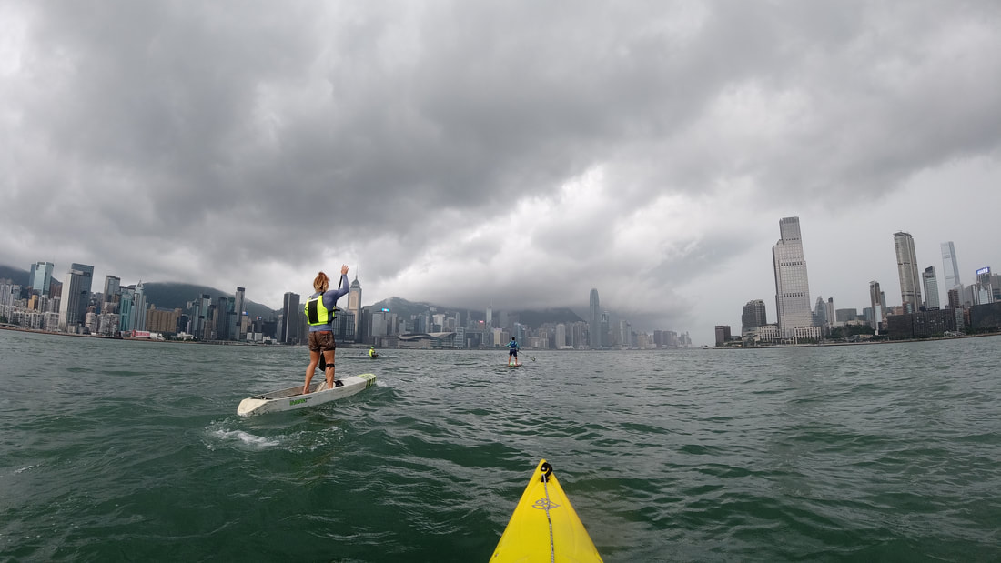
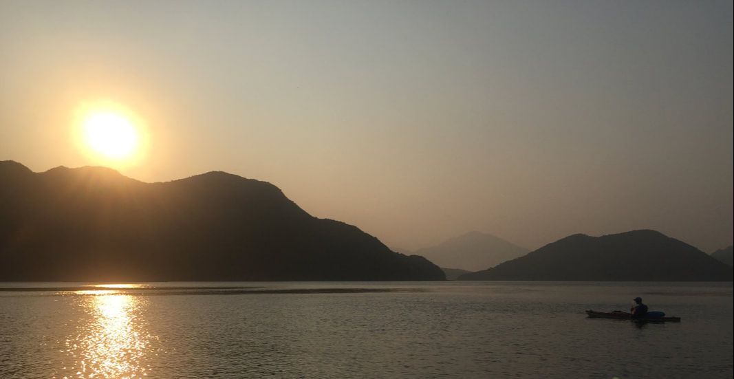
An Island of contrasts; one side among the most densely populated on earth, the other uninhabited in many parts. We were 4; a sea kayaker, an outrigger paddler and two stand up paddle boarders. Together completing the 46km voyage around Hong Kong Island in one trip just over 9 hours in duration, a bucket list item no longer! 💪🏼 💦 #wildhongkong #aroundtheisland #sheko #hkisland #hongkong #paddle #geopark #thisishongkong #typhoon #summer #adventure #paddling #beach #sup #stunner #fun #hkiger #discoverhongkong #wild #vista #hk #wildhk #hkig #photooftheday #gopro #wanderlust #drone #shelterisland
1 Comment
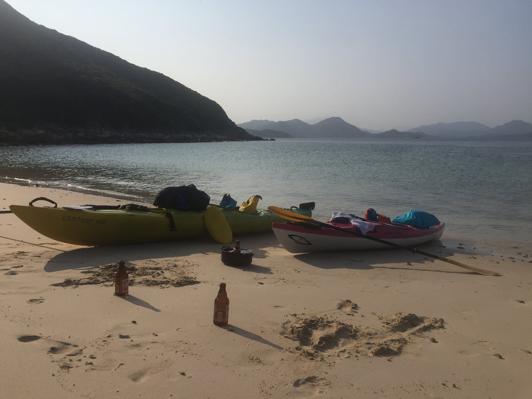
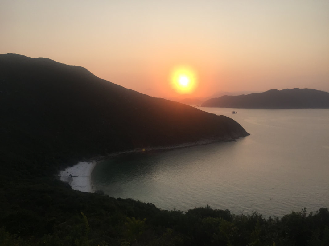
Kayaking around HK 🚣🏼♂️ 🇭🇰 - 260km around Hong Kong, paddling on the outside of all the outermost islands in an epic local adventure. 1st leg - 📌 Sai Kung to Lamma Island - Paddling from Sai Kung to the south, a night was spent camping under the stars on the rugged Ninepin archipelago. From the Ninepins lay an open stretch ahead, across a few easterly swells to Waglan and Po Toi where an afternoon was spent stretching the legs across the Islands’ many footpaths. 2nd leg - 📌 Lamma Island to Mai Po - Was an absolute pleasure to link up bright and early with DJ on the northern shores of Lamma Island and make a circumnavigation (i went about 90% of the way round) of his home Island together! Once at the power station we parted ways and I crossed in unusually serene sea conditions to Cheung Chau. After a comfortable stay overnight, I linked up with Mark with batteries charged and we made rapid progress reaching the Soko Islands with plenty of time to explore the area. Highlights being the abandoned Vietnamese refugee camp and most vivid bioluminescence I have ever witnessed. Winds picked up a bit over night providing a blustery crossing to South Lantau, home to freshwater pools and a big feed at Tai O. Paddling under the bridge to Macau we’d hoped to see pink dolphins, but without luck. This marked a turning point in our surroundings, which from then on became increasingly industrial as we approached and navigated through Shenzhen Bay. The finale of this leg could not have provided starker contrast, a majestic sunset paddle through the tranquil wetlands of Mai Po. 3rd leg - 📌 Luk Keng to Sai Kung - A return to solo paddling for the final leg set in motion a 2 day epic paddle; crossing Mirs Bay twice before rounding Sai Kung Peninsula to complete my loop around HK. The first task at hand was to transport the kayak across HK’s land border with China to Starling Inlet. Tranquil mangroves at Luk Keng soon emerge onto open waters and after crossing 30km over to Tung Ping Chau in light headwinds, I was in position to follow that up with a big paddle the following day. A northerly front swung through overnight and an early start helped to propel me homewards through increasingly tumultuous waters. 50km later, I was home and the trip was done 👍🏼
Info on DJ's series 'Drone & Phone'; https://www.droneandphone.com/ https://www.facebook.com/droneandphone/
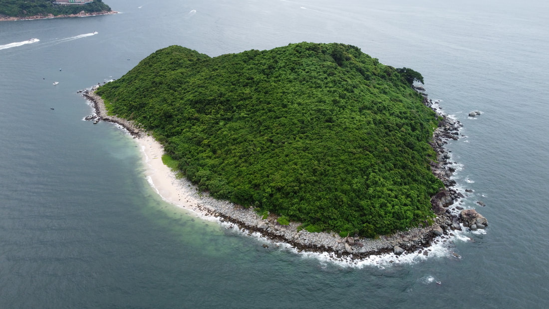
Info on Mark's row across the Northwest Passage; https://nwpexpedition.com/ https://www.facebook.com/NWPexpedition Filmed by Rory Mackay & Jack Yao Produced by Rory Mackay #kayakingaroundhongkong #wildhongkong #kayaking #adventure #maipo #shachau #lantau #sokoislands #Cheungchau #lammaisland #winter #paddling #beach #hongkong #stunner #fun #hkiger #discoverhongkong #wild #vista #bliss #hk #wildhk #hkig #photooftheday #gopro #wanderlust #drone #lukkeng #tungpingchau #tailongwan #saikung #mirsbay #starlinginlet #ninepins #waglanisland #potoi There are many spots in Hong Kong that can feel far removed from the city, but are in fact just round the corner or over the hill from town. Then, there are those rare spots that are genuinely far removed from civilization. The Southern waters off Lantau Island are such a locale. Within these waters lie a somewhat forgotten and neglected archipelago; the Soko Islands. 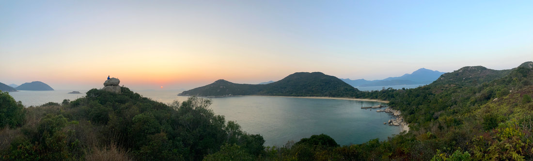 A great option for intrepid day trippers, yet still family friendly, little about a visit to the Soko Islands is routine. As there are no scheduled boats you will need to arrange your own, however if you make the effort to venture to this remote area you will be rewarded with a trip back in time! An untarnished landscape bursting with pristine beaches and historical relics lies in wait. 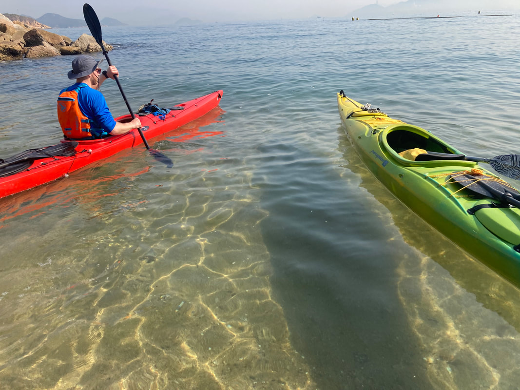 If not travelling on your own private boat or charter such as a junk, then (other than kayaking), the simplest way to reach the Sokos is via Cheung Chau. From Cheung Chau you can agree a fee with a local boat operator to drop off and pick up within one day. Incidentally if one wants to kayak there, kayaks can be rented from Cheung Chau too, but it is only advised for more experienced sea farers as you will cross exposed bodies of water. If in any doubt, arrange for a guide. There are 2 main islands that one would spend time ashore on here, Siu A Chau and Tai A Chau. Both have several stunning beaches to enjoy and a small pier that a smaller vessel can safely alight at. 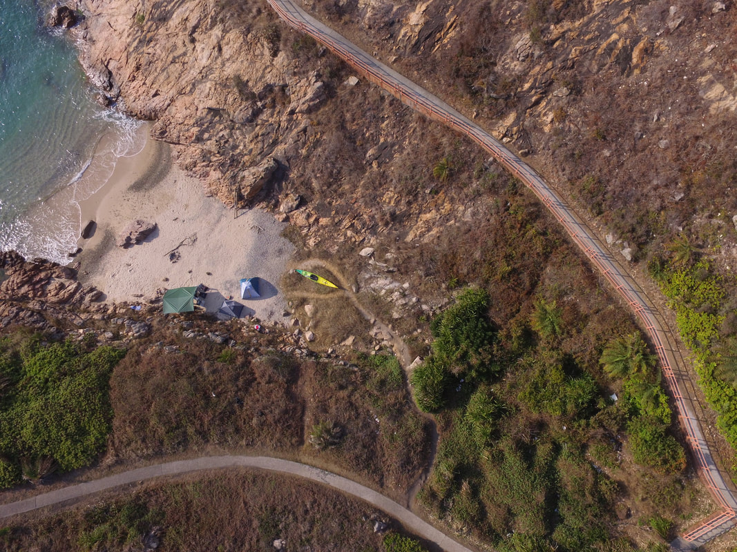 Up till the late 1970s, the Soko Islands were home to merely a couple dozen farming families, tending to small scale agriculture and fishing in order to survive. This all changed in the following decades as Tai A Chau became home to an ever-expanding refugee camp housing people fleeing the conflict in Vietnam. Although the Vietnam War came to an end, the ensuing issue of these refugees was never properly resolved. The Soko Island camp was gradually shut down by the government approaching the 1997 handover and inmates were transferred to camps elsewhere in Hong Kong. It’s absolutely incredible to see just over 25 years on, how little of the camp remains. For the most part, concrete foundations and not much else. But a closer look reveals smaller details of what once stood at the site of the camp. 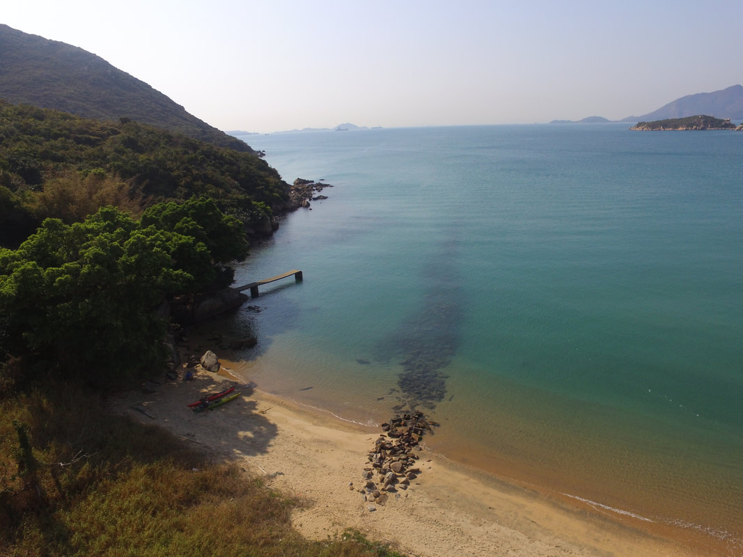 The Sokos are an incredible part of Hong Kong to explore. Any adventure here will leave you with great memories and a sound appreciation of the living standards most of us enjoy in that big city, just across the sea.
Sai Kung native Rory Mackay kayaked 250km around Hong Kong, paddling on the outside of all the outermost islands in an epic local adventure. Rory cast off from the shore just 20 metres in front of his house near Sai Kung, and kayaked in three legs; "Paddling from Sai Kung to the south, a night was spent camping under the stars on the rugged Ninepin archipelago. From the Ninepins lay an open stretch ahead, across a few easterly swells to Waglan and Po Toi where an afternoon was spent stretching the legs across the Islands’ many footpaths. Was an absolute pleasure to link up bright and early with an old friend called DJ on the northern shores of Lamma and make a circumnavigation (I went about 90% of the way round) of his home Island together! Once at the power station we parted ways and I crossed in unusually serene sea conditions to Cheung Chau. After a comfortable stay overnight, I linked up with another mate called Mark for the remainder of the second leg with batteries charged and we made rapid progress reaching the Soko Islands with plenty of time to explore the area. Highlights there being the abandoned Vietnamese refugee camp and most vivid bioluminescence I have ever witnessed. Winds picked up a bit over night providing a blustery crossing to South Lantau, home to freshwater pools and a big feed at Tai O. Paddling under the bridge to Macau we’d hoped to see pink dolphins, but without luck. This marked a turning point in our surroundings, which from then on became increasingly industrial as we approached and navigated through Shenzhen Bay. The finale of this leg could not have provided starker contrast, a majestic sunset paddle through the tranquil wetlands of Mai Po. 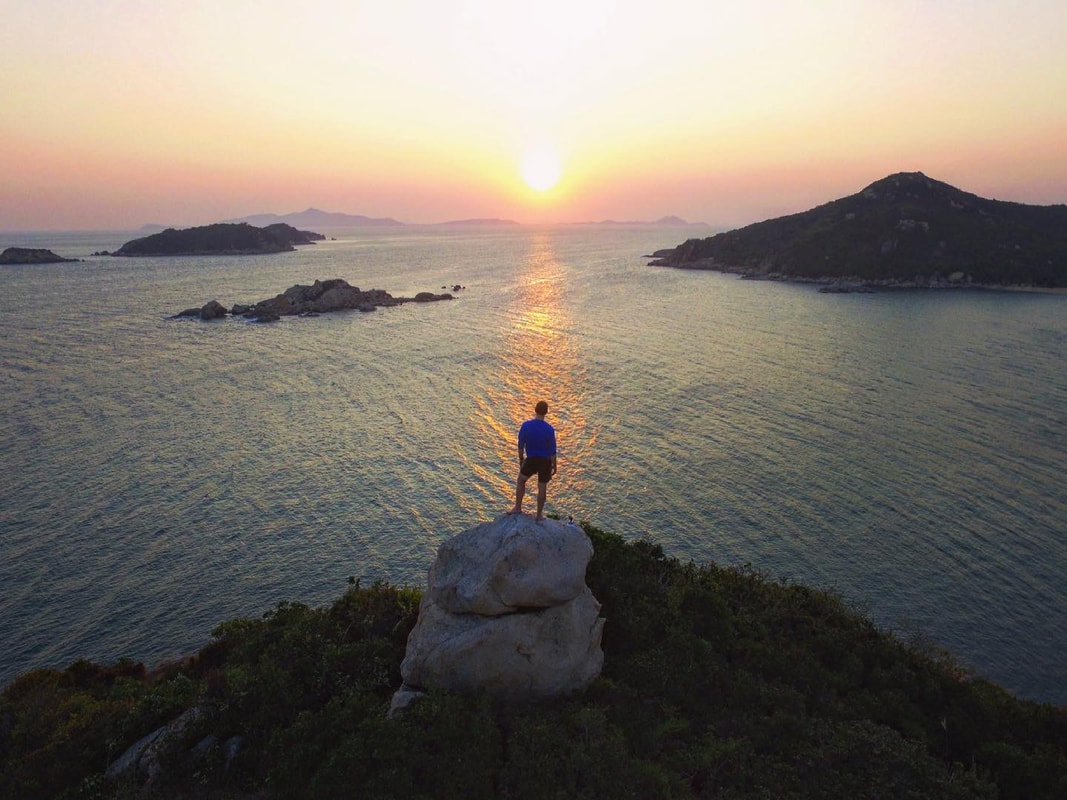 A return to solo paddling for the final leg set in motion a 2 day epic paddle; crossing Mirs Bay twice before rounding Sai Kung Peninsula to complete my loop around HK. The first task at hand was to transport the kayak across HK’s land border with China to Starling Inlet. Tranquil mangroves at Luk Keng soon emerge onto open waters and after crossing 30km over to Tung Ping Chau in light headwinds, I was in position to follow that up with a big paddle the following day. A northerly front swung through overnight and an early start helped to propel me homewards through increasingly tumultuous waters. 50km later, I was home and the trip was done." 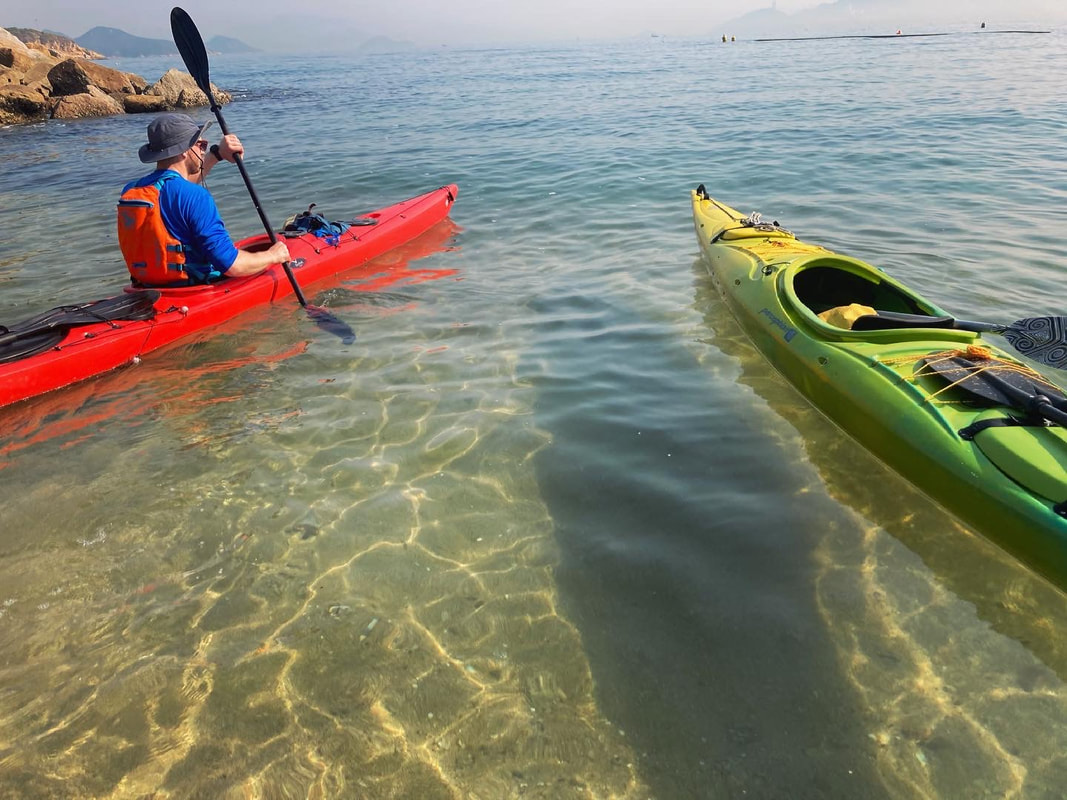 To see more, you can also see the below article about this trip covered by the South China Morning Post; https://www.scmp.com/sport/outdoor/extreme-sports/article/3124652/kayaker-paddles-250km-around-outside-hong-kong-filling?utm_source=copy_link&utm_medium=share_widget&utm_campaign=3124652 Rugged, windswept and diverse, Tung Ping Chau possesses a little bit of something for everyone. From family friendly walks and pristine white sandy beaches to rock formation adventures and historical rekeys. No matter how you wish to play things, this will be a full day outing at the very least. There are only two ways to reach Tung Ping Chau, either by private/chartered boat or by taking the public ferry (Weekends and Public Holidays only) from Ma Liu Shui in Sha Tin. Departing from Ma Liu Shui: 09:00am (or 15:30pm Saturdays only) and departing from Tung Ping Chau: 17:15pm. Fare: $90 return ticket). 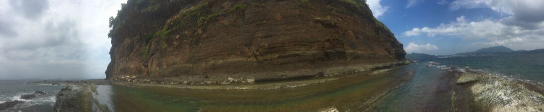 The ferry journey from Ma Liu Shui takes 1.5hours to complete, so sit back and relax enjoying the views of Tolo Harbour. A landscape of tranquil channels lined with red rocks (unique to this part of HK), before emerging upon the open waters of Mirs Bay. Located in the heart of the Tung Ping Chau close to the pier, lies the only major settlement of note on the isle and definitely deserves a pit spot upon arrival. After a refreshing drink and bite to eat, one could easily spend the best part of a couple of hours strolling the adjacent Northeastern beaches, interspersed by crumbling Hakka houses and shade yielding Banyans.
The unique geology of Tung Ping Chau on the other hand is a much more enduring attraction to spend your time exploring. The best way to discover the island is by circumnavigating the Ping Chau Country Trail, which at 5km typically takes around 2hrs to walk in one go without any long breaks. However, stopping along the way to explore all the incredible sedimentary rock formations on show, or delving into the interior of Tung Ping Chau is what this Island is all about. Possessing the youngest rocks in Hong Kong, there are numerous laminated coastal shelfs and sea cliffs to witness. 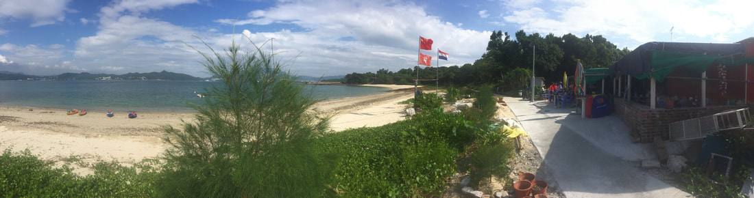 Be sure to catch the final boat leaving the island for return to Sha Tin at five o’clock, unless taking your own boat back or camping overnight is more your thing. Camping in HK can be an awesome experience and Tung Ping Chau is a superb illustration of this. Beware that there is a lot of ambient light coming from China at night, so try to orientate your camp towards Mirs Bay and get more breeze in the process.
Among the list of Hong Kong’s many outlying places, the castaway isle of Tung Ping Chau is worth the trip at least once. The adventure to and from it, is as much an attraction as the being there is.
Getting to the islands is not straight forward, but that is what makes it all the more alluring. The most common way to reach Double Heaven is by a ride on the ferry from Shau Tau Kok to Kat O, however as this falls within the Closed Border Area, an access permit is required. Alternatively, you can join a private island tour to charter a boat or get a water taxi from Wong Shek Pier. The number 94 and 96R KMB buses go to Wong Shek Pier (96R operates on weekends only). For the more intrepid, one can sail or kayak to the region and utilize many of the secluded anchorages the archipelago has to offer. The primary port of call for all that reach the 4 main islands of Double Heaven is the sleepy village of Kat O. Located on Crooked Island, it is the only major settlement of note in the area and one could easily spend the best part of an hour wondering the laneways; crumbling Hakka houses interspersed with shade yielding Banyans. Enjoy a waterfront stroll and keep an eye out for the three 19th century era cannons, aptly pointed northwards towards the large container port of Yantian. Often visible, this behemoth on the Chinese Mainland provides a compelling juxtaposition between the traditional ways of the Hakka people and the rise of Modern China across the waters. 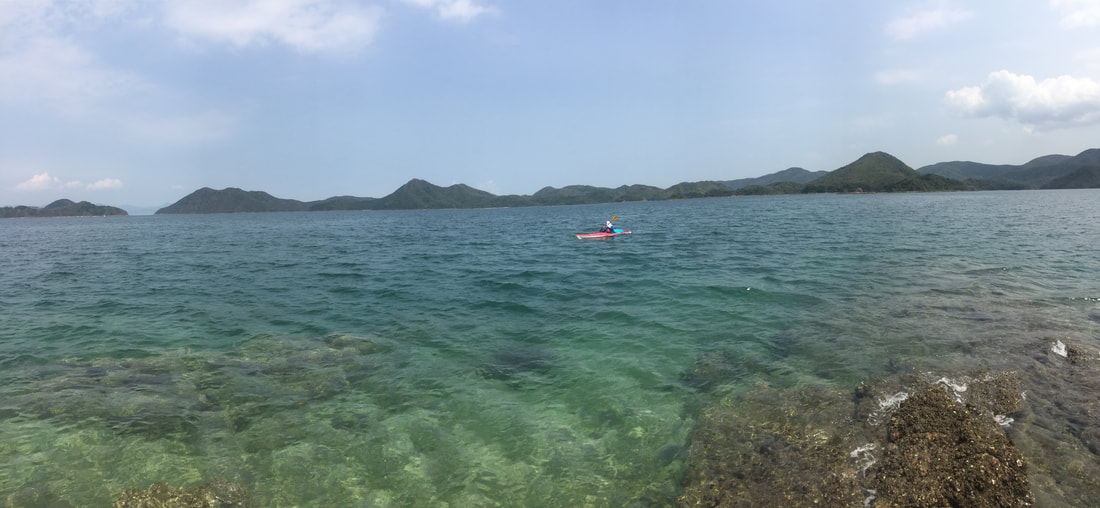 On the water in Double Heaven From Kat O, there are a few short hikes you can pursue across opposite ends of Crooked Island; the most worthwhile being a shorter trail leading Northeast across to a large sandy beach which has views across Mirs Bay. Make sure to indulge yourself with a decent meal and grab fluids in Kat O, as there are next to no such amenities anywhere else. If you have your own boat or kayak, then Kat O serves as a worthy port of call before venturing to more remote areas of the archipelago. 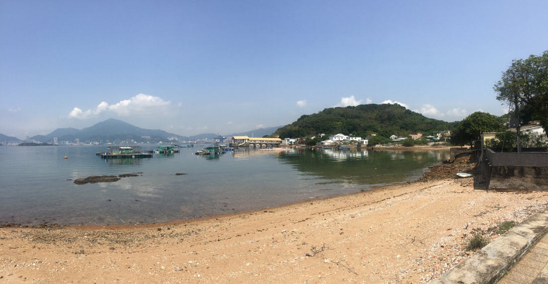 Kat O Waterfront For those who are not so fussed about the logistics of venturing offshore and are happy to get a taster for the area, another option is to visit the coastal portion of Double Heaven near Lai Chi Wo Village. One can reach Lai Chi Wo overland by hiking from Wu Kau Tang in Plover Cove Country Park (take green minibus no. 20R departing at Tai Po Market MTR station to Wu Kau Tang), or by taking a ferry (Sunday and Public Holidays only) from Sha Tin (Depart from Ma Liu Shui: 09:00am. Depart from Lai Chi Wo: 15:30pm. Fare: $50 single ticket, $80 return ticket). 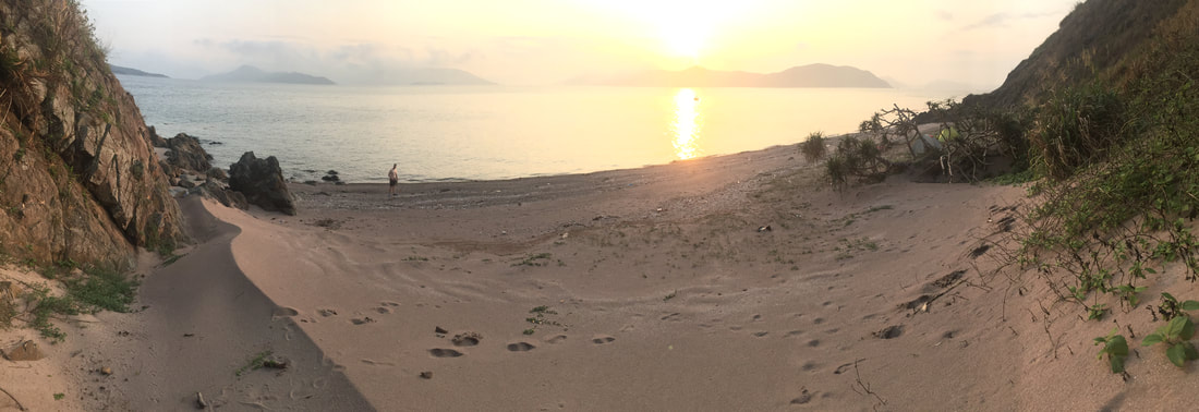 Downtime on the very unique pink sands of Double Heaven The hike from Wu Kau Tang takes you in an Easterly direction over a pass to reveal fantastic views over the entire Double Heaven area, before descending to the coast. Venturing further afield, there are many trails in Plover Cove Country park to choose from. If taking the ferry from Ma Liu Shui, enjoy the views of Tolo Harbour en route before rounding the headland to enter a new landscape of tranquil channels lined with red rocks (unique to this part of HK). Be sure to catch the final boat leaving the island for return to the mainland at 15:30pm, unless hiking back or camping overnight stay is more your cup of tea. Camping in HK can be an awesome experience; there are a few great options around Plover Cove Country Park, the ‘Sam A Chung’ campsite being the best situated of them.
Among the list of Hong Kong’s many regions, the castaway islands of Double Heaven are worth the trip at least once. The adventure to and from Double Heaven is as much an attraction as the being there is. In late March 2020, Wild HK Founder Rory Mackay embarked on a 5 day Kayaking and camping expedition with Mark Agnew from the South China Morning Post. The primary aim was to make a tour of the archipelago which creates Double Heaven. Located in the far flung northeastern corner of the New Territories adjacent to the Chinese mainland, it would require us to cover the best part of 140KM in order to achieve this (starting and finishing in Sai Kung). 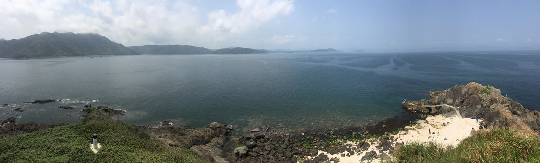 Atop Wong Ma Chau, an obscure little island in the middle of Mirs Bay A world onto its own, Double Heaven by any nations' standards would be considered a remote and relatively pristine place - all the more special for us to visit, given this was in Hong Kong. With all this said however; the adventure (rugged scenery, challenging seas and wilderness beachside camps) either side of exploring Double Heaven was just as exceptional, if not more so. After a shorter half-day on Day 1 in order to get away from Sai Kung town, Day 2 was a mammoth 39KM paddle around the greater Sai Kung Peninsula and across the the mouth of Tolo Harbour to reach Double Island.
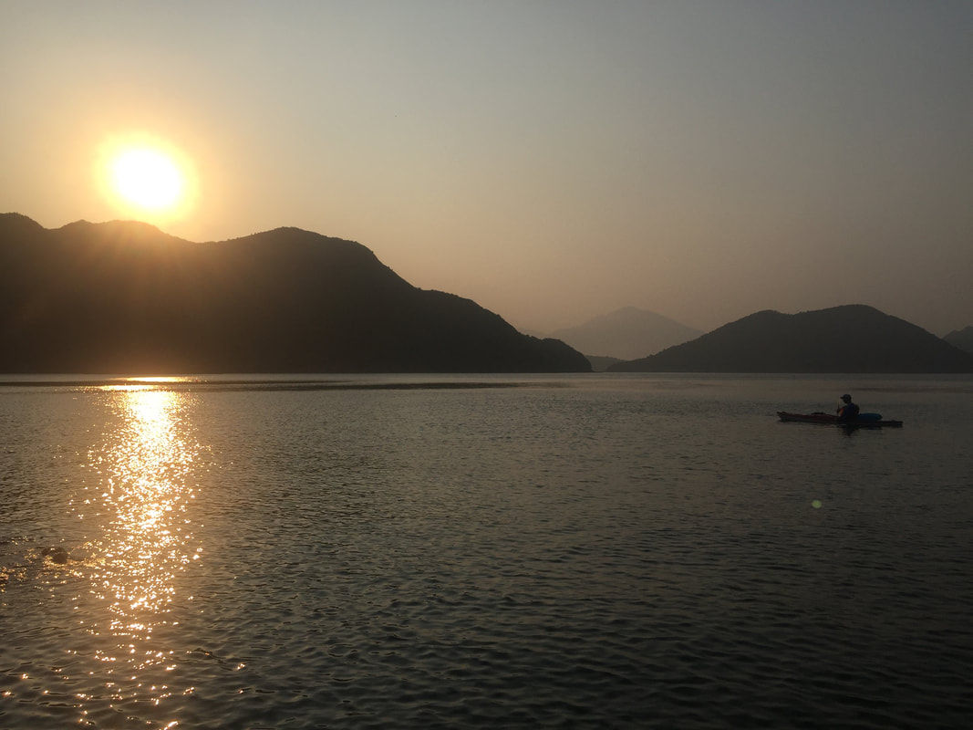
After a big second day, we earned the privilege on day 3 to go at a more casual pace and explore the various passages of Double Heaven. Time was taken off to explore the charming village of Kat O and restock supplies, before heading south and camping overnight on Port Island. A huge effort followed on day 4 as sea conditions were less hospitable than previous days. It was graft paddling upwind much of the way and most satisfying to arrive at Bluff Island for a short hike and one of the best sunsets I've ever seen (no joke, have seen plenty)! The place was paradise; icing sugar sand, luminescent plankton, no plastic and a decent stash of fire wood.
Last day of the trip we made a detour of sorts to explore sea arches and caves on Basalt, Bluff and Jin Islands, before completing formalities. Although we don't take this trip as a guided tour, or necessarily advocate getting to Double Heaven in the manner we did (it is hard work and requires ocean going experience) - I highly recommend for anyone who regards themselves as a real 'Hong Konger' to visit this remote enclave at least once in your life. Other than kayaking or taking your own boat out there, one can take a ferry to Kat O on weekends and Public Holidays. 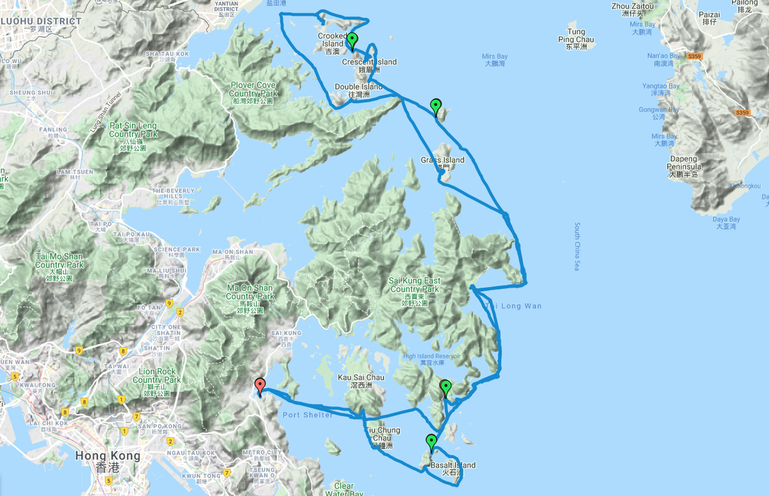 Map detailing our route summary - covering approximately 140KM over the 5 day voyage. 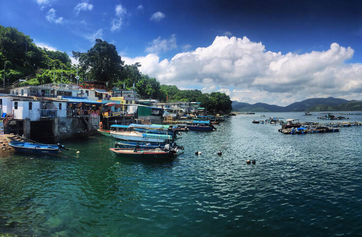 Fancy a day out to one of the most underrated scenic places in Hong Kong? Then the remote little island Tap Mun could be right up your street! Tap Mun or Grass island is located in the North Eastern side of Hong Kong. The local community of Hakka descend is mainly fishermen. You can find temples, camping facilities, basketball court, seafood restaurants and a scenic trail around the island flanked by grass fields.
Take 101M mini bus from Exit A2, Hang Hau MTR station to Sai Kung. From Sai Kung pier, take bus 94 from Sai Kung to Wong Shek Pier, You can also take bus 96R From Diamond Hill MT station. The boat trip from Wong Shek Pier to Tap Mun takes around 30 minutes and costs HK$9.50 on weekdays, HK$14 on weekends and public holidays. 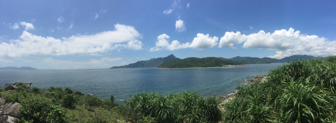 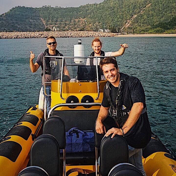 If you fancy a memorable speed boat adventure in HK, we suggest you look no further than Zoom HK! Nigel (Top left of image) is now up and running taking folk out on trips around the waters of Hong Kong. We had a fab time yesterday seeing what all the fuss was about :)
Find out more at http://www.zoomribs.hk/
The beauty and diversity of Hong Kong’s landscapes is simply stunning, we are immensely fortunate to have such places in our ‘back yard’ to explore at will. During the hot summer months, kayaking is an ideal way to do this. Although paddling opportunities in Hong Kong are well documented for the most part, there are a few other options out there that fly under the radar a little bit. Below I share with you two different locations in the wilds of Sai Kung Country Park that will take your breath away.
Despite feeling like a complete wilderness, there are parts of the outermost Sai Kung peninsula that are very accessible. The village of Hoi Ha provides an ideal spot for beginners and families that almost anyone could have a crack at; whilst our other featured location at Pak Lap Wan is a much more intrepid paddling experience at the best of times. 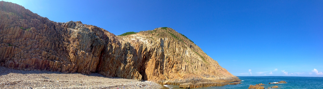
HOI HA
Nestled on the southern end of a stunning coastal inlet, Hoi Ha is a sanctuary for many types of marine life and is among the most pristine places to be found in Hong Kong. Never mind the kayaking, for many the beautiful journey just to get there is worth the effort. However, once you dip your paddle into her clear calm waters, Hoi Ha takes on an entirely new aura. Getting to Hoi Ha is pretty simple despite its far-flung location. Simply make your way to Sai Kung ferry pier, then embark on either a 20-minute minibus or taxi ride to Hoi Ha village. The minibus runs every half hour and a taxi will set you back around $120. Try to make this trip on weekdays, as there is a lot of pressure on transportation during weekends and public holidays! Don’t leave it too late in the day to head home either. From the bus stop, walk through the village directly down to the waterfront where there are a couple of different vendors of kayaks. One can rent a single kayak, life vest and paddle for $100 per day or double kayak at $200 (locker expenses included on weekdays). Once on the water, Hoi Ha inlet is a joy to explore. With abundant sea life, scattered coral beds and beaches aplenty, there is more than enough to fill a day. If you’re eager to venture out further, navigate around the headland towards Wong Shek or Tap Mun Island and capture fantastic vistas of Sharp Peak. 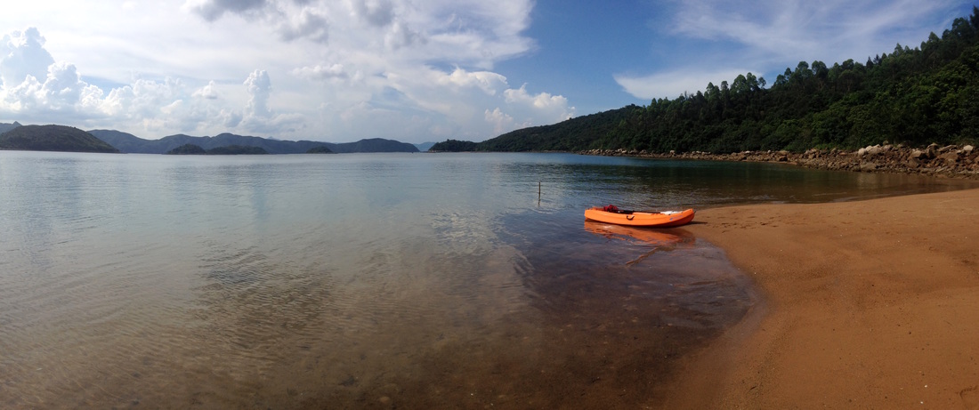
PAK LAP WAN
Tucked away in the secluded eastern reaches of Sai Kung Country Park, Pak Lap Wan is a great location for a number of activities and serves as an ideal launch pad into the Hong Kong Geopark. Pass the dramatic High Island reservoir and through grassy fields home to numerous wild cattle, before reaching the white sands of Pak Lap Beach. Embark on an adventure in search of rocky islands and untouched beaches. But unlike peaceful Hoi Ha, once you escape the confines of Pak Lap Wan, you’re out in pretty exposed territory. Between April and September, the easterly trade winds tend to deviate elsewhere and this is the prime time to paddle the Geopark. You may get lucky during the other half of the year, but be prepared to paddle through swell and stay clear of the rocks. If the conditions do indeed turn out to be a little choppy on the day, then one can hug the coastline and head for the sheltered waters of Sai Kung harbour to the west. Although the rock formations there are not as pronounced, they are still impressive. But when winds and swell come from the east, make sure you are fully prepared! Pay close attention to forecasts and sea conditions prior to departure on the day; if you are not sure, then it is better to paddle somewhere safer like Hoi Ha or Sai Kung Town. 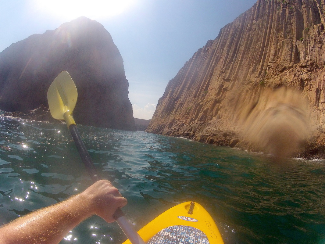
The best way to reach Pak Lap Wan is by taxi from Sai Kung Town ($110) and walk down the hill from the road to the beach, the walk should take no more than 10 minutes. Once at the beach, there is a small building that rents out kayaks, camping equipment and prepares basic meals. A single sit down board will put you back $100 for the day; this includes a paddle and life vest. On busier days, there is sometimes the option to return to Sai Kung by speedboat. Out on the water one can either; follow the coastline northwards past rugged cliffs and around to the white sands of Long Ke for a picnic lunch, or paddle southeast to explore the dramatic sea arches of Wang Chau and Basalt Island.
I will reiterate that heading out on the open waters around the Geopark is not recommended for beginners and would recommend joining a tour group. Two operators provide tours here; ‘Kayak and Hike Ltd’ run by Paul Etherington who specializes in Geopark paddles and my company ‘Wild Hong Kong’ operates tours to both the locations mentioned above. |
Categories
All
About usWe are one of Hong Kong's premier adventure & eco tour operators. This is our blog, documenting many of the wild places we explore and show guests. Archives
June 2024
|

 RSS Feed
